Waiting for Storms to Develop
A warm, moist airmass continues across Alabama and it is going to feel more like June than May over the next several days. In fact, May could be the new June if our weather keeps trending the way it has.
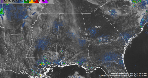
INTERESTING SITUATION THIS AFTERNOON: An outflow boundary from overnight thunderstorms moved down into North Alabama this morning. It was slowing down as it approached a line from Haleyville to Pinson to Heflin. South of the boundary, cumulus clouds were growing n the unstable air, where CAPE values were in the range of 2,000 to 3,000 j/kg, which is quite healthy for storms. There is no cap, so storms will eventually start to fire, especially as heating continues and slightly cooler air aloft overrides the low level air. In our favor, the moisture over Alabama is not very rich and the upper level wind fields are rather light. Still, having said that, storms that do develop could become strong or even severe. The SPC has a slight risk area painted across Central Alabama south of the outflow boundary south to around US-80.
The best chance for storms will run through 8 or 9 p.m. A few showers bubbled up earlier near Cullman but died out quickly and some others tried to get organized near the track at Talladega just after 2 p.m. but they had dissipated completely by 2:45 p.m.
Afternoon temperatures will rise in to the upper 80s for most locations. Tonight will see muggy lows between 64F and 67F.
KEEP AN EYE ON THE SKY…in case any storms develop in your area. And have a reliable source for weather information through the evening hours that can communicate any warnings that do happen to you. Fortunately, the chance of a tornado is nearly zero across Central Alabama.
Category: Alabama's Weather


