Slight Risk Introduced for Southeast Alabama
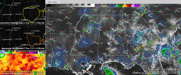
The SPC has posted a “slight risk” severe weather outlook for the southeastern quarter of Alabama. This is their standard lowest end severe weather forecast, indicating that there is a possibility of organized severe weather. That is in the upper left panel of the graphic. Click to enlarge it.
They just also added a mesoscale discussion, which is their heads up that a watch might or might not be needed. They indicate a 40% chance they might issue a severe thunderstorm watch for parts of SE Alabama, SW Georgia and North Florida. That is in the left middle panel.
The airmass over the region is becoming highly unstable and there is a small amount of capping that will keep a lid on things for awhile. Wind shear is very low though, so storms will generally be of the summertime pulse variety, quickly developing and then raining themselves out. Watch out for damaging winds with all of the heavy precipitation being suspended aloft, then crashing to earth.
A couple of isolated showers are forming across Central Alabama, a sign of things to come.
Category: Alabama's Weather, Severe Weather


