Strong Storms

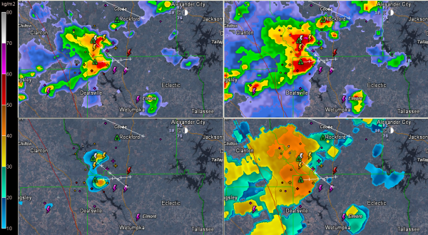
Click to enlarge image. Clockwise from top left, radar reflectivity from the lowest tilt, composite reflectivity, storm tops, vertically integrated liquid.
The storm over southeastern Chilton and northwestern Elmore counties is very close to becoming severe this afternoon.
It is showing signs of producing damaging winds and some hail. The damaging wind threat is the greater of the two threats. Lots of dangerous lightning and torrential rains as well.
The strongest part of the storm is between Verbena and Rockford pushing south or southeast at 15 mph.
Elsewhere, some strong storms are over northern St. Clair County between Ashville and Ragland. They have peaked and are weakening now.
Category: Alabama's Weather, Severe Weather


