An Update Just Before 2:30
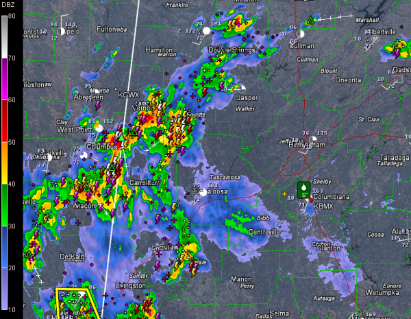
Storms over Central Alabama have shifted mainly westward this afternoon.
Areal flood advisories are in effect for parts of the following counties:
Choctaw County until 6:15 p.m .
Etowah until 4:15 p.m.
Fayette/Lamar until 4 p.m.
Walker/Winston until 3:45 p.m.
Greene/Hale/Pickens/Tuscaloosa until 3:45 p.m.
An areal flood warning (more serious) is in effect for western Shelby County until 4:30 p.m.
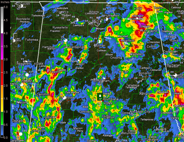
5.30 inches of rain fell at the fire station in Alabaster
The bottom line is that we don’t want you to wade or drive into any flooded area.
Here are some rainfall amounts since yesterday morning as estimated by the BMX Doppler.
At 2:15, radar indicated much of the heavy weather had shifted into western Alabama. But there were heavy storms capable of producing localized flooding over northern Etowah County north of the Attalla/Gadsden areas.
In western Alabama, the heaviest storms were in two groups. One includes parts of Lamar, Fayette, Pickens and Hale Counties. Some of the heaviest rain was between Vernon and Millport as well as from Fayette south to near Gordo.
The other area is over northern Choctaw into southern Sumter Counties. This activity is well south of I-59.
Overall, everything is moving south slowly.
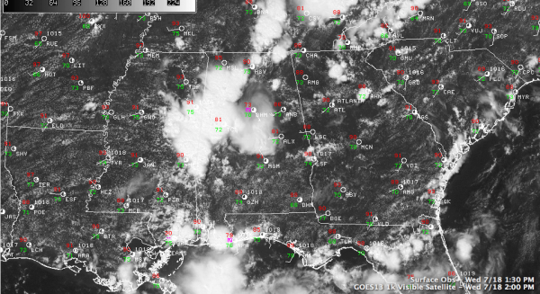
Look at this beautiful visible satellite image of the Southeast, clearly showing the storms over Alabama.
Skies have cleared over East Alabama, where it was 86F at Anniston. It was 73F at Birmingham.
BUSY DAY NATIONALLY
Over 50 current warnings nationally, including one tornado warning, nearly a dozen flash flood warnings and many severe thunderstorm warnings. Look at this list from my Gibson Ridge Software taken a short while ago.
Category: Alabama's Weather, Severe Weather


