Wet At Times Through Friday
An all new edition of the ABC 33/40 Weather Xtreme video is available in the player on the right sidebar of the blog. You can subscribe to the Weather Xtreme video on iTunes by clicking here.
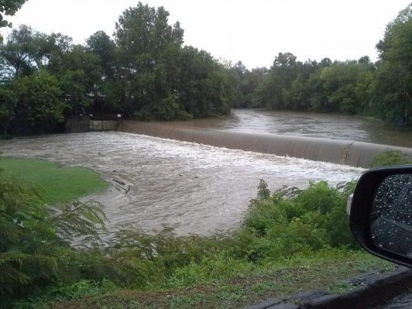
MESSY MORNING FOR SOME: A cluster of storms formed over the I-65 corridor in the Birmingham metro at mid-morning, and dropped 2 to 4 inches of rain on parts of Jefferson and Shelby Counties, producing some flooding problems… see Buck Creek at Helena…
Roads were closed around Alabaster for a while, but the water is receding this afternoon.
THIS AFTERNOON: The air is now cool and stable around Tuscaloosa and Birmingham; most of the active storms are now well to the north, over the Tennessee Valley, and to the west over Mississippi. Our friend King TUTT (a tropical upper tropospheric trough), just east of here, has prodded the enhanced coverage of showers and storms. And, it has also kept temperatures down. Looking at the hourly observations, Birmingham’s high so far today is only 77 degrees… the record low maximum for today is 79 set way back in 1906. I get the idea we will make to just past that over the next two hours, but we are very close to record levels for a cool July day. (We just hit 80 at 3:00… so no record)
TOMORROW/FRIDAY: The TUTT will stay in the same place, and we expect scattered to numerous showers and storms both days. Where the sun breaks out for a while, the high will be close to 90, but where showers and storms form early in the day, we will be well below that. Again on these days we have potential for beneficial summer rain for most communities.
OUR WEEKEND: Showers and storms should become fewer in number Saturday and Sunday as the upper feature dissipates and heights rise. We will roll with the typical summer forecast… partly sunny days with a few scattered showers and storms each afternoon. Highs should be in the low 90s. And, that kind of weather should continue into early next week.
GULF COAST WEATHER: Showers and a few storms are likely tomorrow and Friday, especially over the Florida Panhandle in places like Destin and Panama City. Then, for the weekend, the weather will be improved with about 6 to 8 hours of sunshine both days with the usual chance of scattered thunderstorms. Highs will hold in the upper 80s, and the sea water temperature this afternoon at the Dauphin Island Sea Lab is a warm 88 degrees.
TROPICS: All remains quiet… there is a vast area of dry air over the Atlantic basin preventing any tropical action. See the Weather Xtreme video for the details.
WEATHER BRAINS: Don’t forget you can listen to our weekly 90 minute netcast anytime on the web, or on iTunes. This is the show all about weather featuring many familiar voices, including our meteorologists here at ABC 33/40.
CONNECT: You can find me on all of the major social networks…
Look for the next Weather Xtreme video here by 7:00 a.m. tomorrow…
Category: Alabama's Weather


