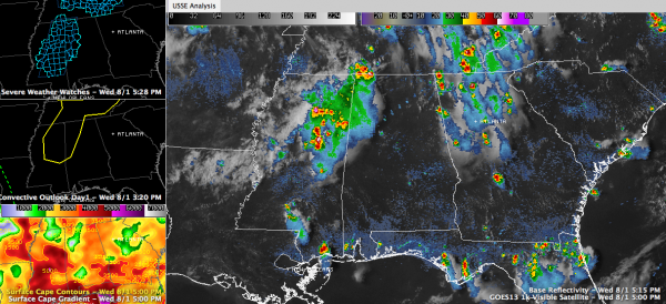
Radar Update 5:30
Most of Alabama (95% or more) is high and dry at this hour.
The storm that moved into Cherokee County from Georgia weakened considerably. There is still a small strong cell near Pleasant Gap in southern Cherokee County. It is moving SSW in the general direction of Piedmont. It will affect extreme northwestern Cleburne and northern Calhoun Counties.
The storm that moved from Itawamba County MS literally fell apart as it approached Marion County.
The storm near Columbus AFB looks like it hit the Alabama/Mississippi border and bounced back.
The storm over the northwest corner of the state is also weakening.
Did someone turn on the storm shield over Alabama this afternoon?
A severe thunderstorm watch does continue until 10 p.m. for much of Northwest and West Central Alabama. There are some strong storms still over eastern Mississippi and it remains to be seen if they will hold together into Alabama.
Category: Alabama's Weather


