Not Ernesto…Yet
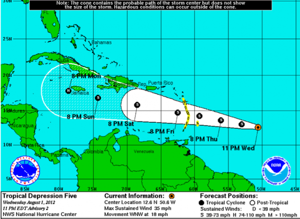
By the time you have breakfast in the morning, tropical depression number 5 may be Tropical Storm Ernesto. Or, if you listen to the European model, it may be well on its way to weakening back into a tropical wave.
Air Force reconnaissance will fly into the system tomorrow. It is a little more than 600 miles east of the islands, moving west northwest at just under 20 mph. This means it will reach the islands in less than 48 hours and tropical storm watches have already been posted.
It will track across the Caribbean, encountering less wind shear as it goes, and strengthening should ensue by early next week, if it holds together.
Where it eventually goes is up in the air, but the Yucatan and southern Mexico look most likely.
Category: Tropical


