Isaac More Of A Threat To The Central Gulf Coast
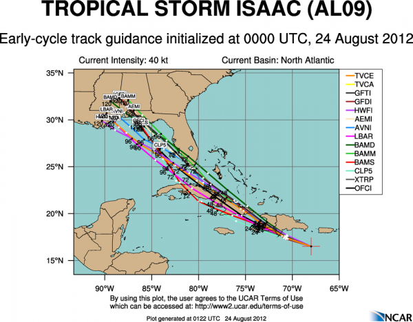
The new model set tonight has shifted west…
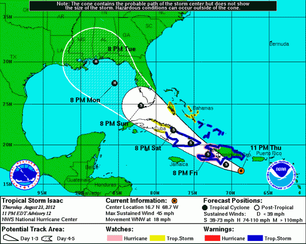
And, the new NHC track just in brings Isaac to near Mobile Bay Tuesday night…
Below is the discussion from the Friday morning forecast package just posted over on the seven day page. I will have a new Weather Xtreme video and blog discussion up here by daybreak tomorrow. Stay tuned…
ISAAC MORE OF A THREAT TO THE CENTRAL GULF COAST: Quite a challenging forecast this morning with potential for a Gulf of Mexico hurricane in coming days. But, in the short term Alabama’s weather will remain quiet with mostly sunny days and fair nights through the weekend. Humidity levels will slowly rise, and we will mention a small risk of a shower tomorrow and Sunday, but most places should remain dry. Then, next week, our weather will all depend on the track of Isaac.
THIS MORNING: Isaac is still a disorganized, weak tropical storm in the Caribbean south of Hispaniola. The circulation center has been reforming to the south over the past 24 hours, and position more to the south over the Caribbean will mean a threat to the Gulf Coast more to the west than initially thought. Isaac will move over Cuba tomorrow, and should emerge into the southern Gulf of Mexico Monday morning. Isaac is expected to remain well below hurricane strength this weekend due to the interaction with Cuba.
NEXT WEEK: Computer models have shifted to the west, and most show a potential landfall on the Gulf Coast somewhere between the mouth of the Mississippi River and Panama City Tuesday or Wednesday. Unfortunately, it looks like conditions are favorable for Isaac to not only to grow into a hurricane, but potentially a dangerous hurricane due to high ocean heat content and a favorable upper air pattern. Isaac will be crossing the warm loop current over the Gulf, and could spin up in a hurry. However, there is little skill in forecasting hurricane intensity five days in advance.
CALL TO ACTION: Keep in mind the forecast track could very well change again, it is still early in the development stage with Isaac, but based on model trends, we advise those that live on the coast from New Orleans to Dauphin Island to Gulf Shores to Destin and Panama City to begin preparations for a hurricane as a course of least regret. Get a readiness kit together now, and think about where you will go if an evacuation is needed at some point next week.
NORTH/CENTRAL ALABAMA: We will go ahead and increase the chance of rain here, along with increasing wind on Wednesday. We simply don’t have enough confidence in the forecast track of Isaac to forecast any specific rain amounts here, but there is potential for a heavy rain/flooding event at mid-week if we wind up on the wet side (the east side) of the storm circulation.
Category: Alabama's Weather


