Showers On Radar
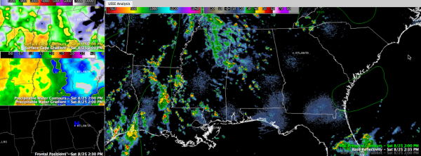
Moisture to the west of us is working into Alabama this afternoon, and the result has been considerable clouds and a few showers along an area of convergence.
The lighter showers over Mississippi are weakening as they run into the Alabama force field (really just drier air).
The heavier showers are over western counties, from Marion, through Lamar, Fayette, Pickens, Greene and Sumter. They are moving north.
Further south, showers and storms are widely scattered over Lowndes, Dallas and Perry Counties. They are moving northwest.
Some of these showers will be sporting lightning soon.
Everything is moving clockwise around the back edge of a ridge of high pressure to our northeast.
Isaac is emerging off the North Coast of Cuba. It should begin strengthening again tonight and will be a hurricane by tomorrow, approaching the Florida Keys.
The morning run of the European is complete. It shows a major hurricane moving inland near Panama City Tuesday evening and curving up into Georgia. The Canadian shows a Southeast Louisiana landfall. The GFS morning run shows a slowly moving hurricane pounding the Mississippi/Alabama on Tuesday and Wednesday before moving up into Mississippi and to near Memphis.
Model hokey pokey continues!
Category: Alabama's Weather


