Severe Weather Remains Possible For East AL
**No afternoon Weather Xtreme video today due to the active weather**
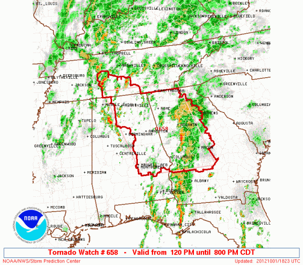
TORNADO WATCH: Below is the tornado watch for much of North and East Alabama until 8 p.m…
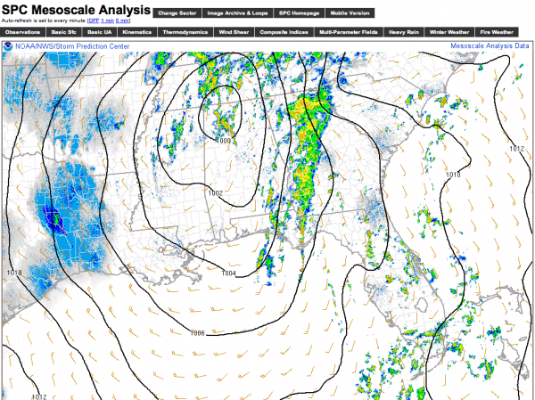
We have a surface low this afternoon over Northwest Alabama, with the warm sector in place over the eastern two-thirds of the state with dewpoints up into the low 70s….
The surface low is moving slowly to the north/northeast… so the risk of a few low topped, short lived tornadoes will continue over East Alabama through the evening hours. We have not had any tornado warnings in our state until early this morning, but be aware that one or two warnings could be required over the eastern counties over the next 3-4 hours, so be sure you can hear warnings if they are needed.
We should note the Birmingham metro is not in the tornado watch…
TOMORROW: A deep upper low will remain nearby, keeping the weather mostly cloudy and unsettled. A few scattered showers are possible tomorrow, and the weather will be much cooler thanks to dynamic cooling. The NAM is printing a high of only 65 degrees for Birmingham tomorrow, and that actually makes good sense considering the strength of the upper system overhead. We might even have a few places over Northwest Alabama that have a hard time getting out of the 50s. This is October, you know…
WEDNESDAY-FRIDAY: We might even look at a small risk of a shower Wednesday over North Alabama as the upper low will take its time in moving out, but for now we will leave the forecast dry with a partly sunny sky and a high in the mid 70s. Thursday and Friday will be dry and warmer with highs back in the 79-83 degree range along with a good supply of sunshine both days.
WEEKEND FORECAST: A cold front slowly works through our state this weekend. Moisture will be rather limited, so for now we don’t expect much more than a few widely scattered showers Saturday and Sunday. This is race weekend at Talladega; the chance of a shower at the Superspeedway both days is only about one in four.
We turn much cooler; the high Saturday will be in the low 70s, and we won’t get out of the 60s Sunday with a cool north breeze.
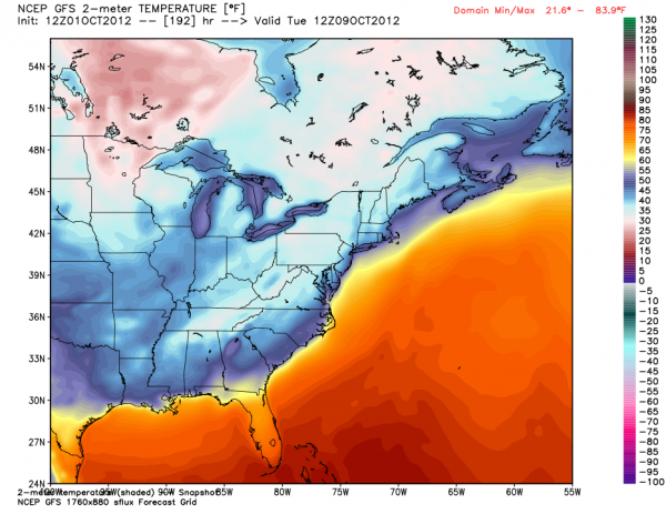
Chilly air will settle into the Deep South early next week; below is the GFS temperature forecast for early Tuesday morning…. sure looks like some of the colder spots could reach the 30s across North Alabama…
WEATHER BRAINS: Don’t forget you can listen to our weekly 90 minute netcast anytime on the web, or on iTunes. This is the show all about weather featuring many familiar voices, including our meteorologists here at ABC 33/40. We will produce tonight’s show at 8:30 p.m. CDT… you can watch live here.
CONNECT: You can find me on all of the major social networks…
Keep an eye on the blog for updates… the next Weather Xtreme video will be posted here by 7:00 a.m. tomorrow…
Category: Alabama's Weather


