

Severe Weather Thursday?
An upper-level low is located near El Paso, Texas this morning, and is moving eastward. It, and the surface low associated with it, will affect Alabama by Thursday morning.
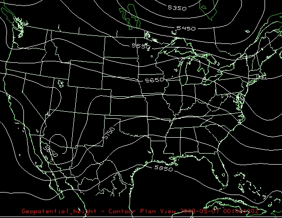
The upper-level low will probably be strongest tomorrow, then open up and weaken as it approaches Alabama (see loop). There will not be much temperature contrast from north to south around here, and that is one of the things that keeps these systems going. But, wind shear will still be significant, with 0-3 km storm-relative helicities over 200. That number is not extremely high, but it is May. Dewpoints will be in the upper 60s and temperatures will be in the 70s, allowing CAPE values over 1,000 J/kg. If the sun comes out Thursday for a few hours, we could easily reach the 80s, which would make the air a lot more unstable.
So, expect scattered thunderstorms on Thursday, and with the wind shear and instability in place, some could be severe with damaging wind and large hail. If we get sunshine, we may deal with a more significant tornado threat. We’ll see.
Category: Uncategorized
About the Author (Author Profile)
Subscribe
If you enjoyed this article, subscribe to receive more just like it.


