A Closer Look At Friday Morning
It will be a close call for freezing rain for Northeast Alabama to start the day Friday.
Global models don’t really have the grid resolution to handle shallow layers of cold air, so the MOS products from the GFS and NAM really won’t reflect the surface temperatures very well in this case, most likely.
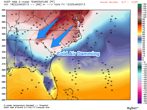
A weak CAD (cold air damming) sets up, where cold air drains down the backbone of the Appalachian Mountains into Northeast Alabama. The higher resolution 4km NAM is actually showing potential for some sub-freezing temperatures over the northeast corner of the state early Friday.
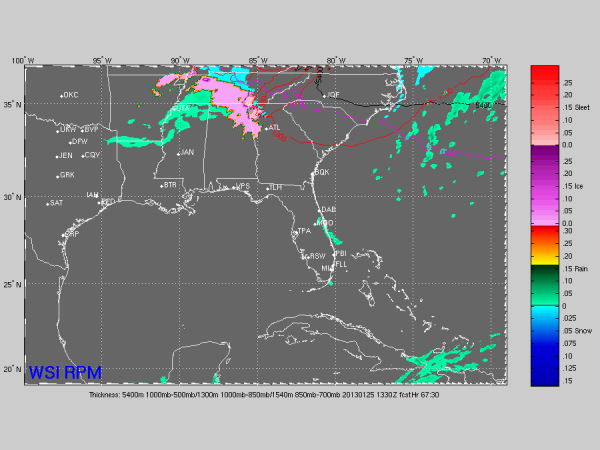
A disturbance will bring rain to Alabama, and the RPM (another higher resolution mesoscale model) shows potential for freezing rain over the northeast part of our state.
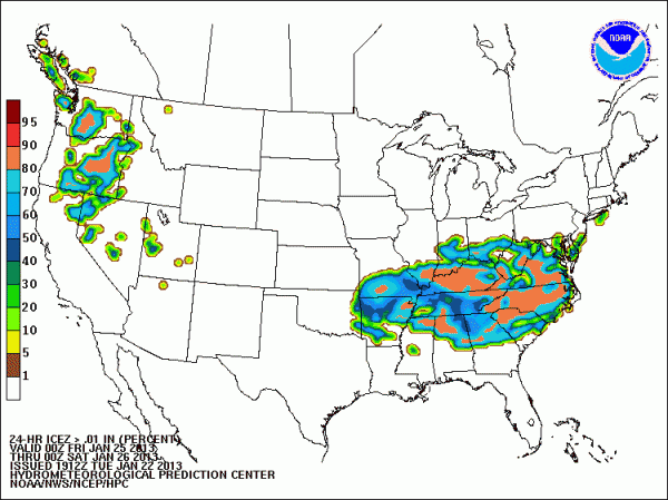
And, we note our friends at HPC show a fairly high probability of freezing rain over North Alabama early Friday.
Remember, freezing rain is not sleet or snow; it is rain that falls in liquid form when surface temperatures are at or below freezing. A long duration freezing rain event can lead to an ice storm, heavy ice accumulation, and power outages.
For now it looks like the main risk of freezing rain early Friday will be over Jackson, Madison, Marshall, and DeKalb Counties of Northeast Alabama, but this is a low confidence forecast for now; we will just have to wait for better model clarity through mid-week. For most of Alabama, temperatures will be above freezing Friday and it will just be a rainy day.
Category: Alabama's Weather
About the Author (Author Profile)
James Spann is one of the most recognized and trusted television meteorologists in the industry. He holds the AMS CCM designation and television seals from the AMS and NWA. He is a past winner of the Broadcast Meteorologist of the Year from both professional organizations.Subscribe
If you enjoyed this article, subscribe to receive more just like it.


