Clouds Hang Tough
Click image to enlarge
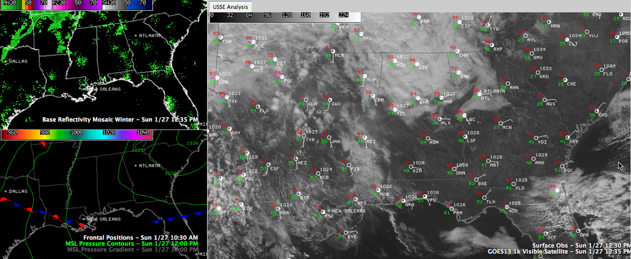
Mid level clouds are hanging tough today across the area.
In fact, there are plenty more where these are coming from as warmer air rides up and over cooler air at the surface.
Many of you are wondering where that warm up is. It is being delayed by the clouds associated with that elevated warm front.
The northern half of the area will have a hard time making it to 60F today. There will undoubtedly be some 70s across South Central sections, where sunshine is more prevalent.
Clouds will start to thicken and lower overnight as moisture levels rise quickly. Can’t rule out he chance of a light shower overnight as well.
NEW WORK WEEK: We will start off cloudy tomorrow, but morning lows will be mild, near 50F generally. With a decent southerly breeze on Monday, highs will make the middle and upper 60s despite the lack of full sunshine. Don’t worry, you will see some sun, but there will be plenty of clouds as well. Monday night lows will be in the middle 50s.
INCREASING SHOWERS: Showers will be on the increase and clouds will be fairly thick on Tuesday as moisture levels continue to build. There should be just enough sunshine to conspire with the warm air that will be hanging around to allow afternoon readings to reach the 70s. It will become quite breezy on Tuesday, with southeasterly winds averaging 7-14 mph, but gusting at times to over 20 mph. Throw in dewpoints in the middle 60s, and you will almost certainly hear someone utter the words, “Tornado Weather”.
SEVERE WEATHER THREAT: Showers and thunderstorms will develop over the Arklatex on Tuesday. They will become severe over Arkansas and Louisiana and will cross the Mississippi River Tuesday evening and be kicking on the door of West Alabama before sunrise. They will cross the state during the morning and early afternoon ahead of a powerful cold front. The arrival time is good news in the instability department, as early morning is the least favorable time for that important factor in severe weather. But up above 20,000 feet, winds are expected to be howling at nearly 120 mph! This means that the thunderstorms that should be preceding the cold front will have the potential to tap the high winds aloft and bring them to the surface, resulting in damaging winds.
We will also be watching for the potential for a surface low to form over northern Mississippi. If that happens, there will be a slightly higher threat of tornadoes as well.
TURN TO COLDER: West of I-65, temperatures will fall Wednesday morning, from morning lows/daytime highs in the lower 60s into the 50s by the time you eat lunch. East of I-65, they will remain steady before falling in the afternoon. By Thursday morning, the cold front will be over South Florida, which obviously qualifies it as moving along at a pretty good clip, as James is prone to say. Lows Thursday morning will flirt with the freezing mark and will struggle to get out of the 40s during the day. Friday highs are almost certainly to be relegated to the 40s after a chilly start in the 30s. Even colder readings are expected Friday night, when readings are expected to drop into the 20s behind a reinforcing cold front that will bring a few clouds and perhaps the chance of a little light rain Friday.
Category: Alabama's Weather
About the Author (Author Profile)
Bill Murray is the President of The Weather Factory. He is the site's official weather historian and a weekend forecaster. He also anchors the site's severe weather coverage. Bill Murray is the proud holder of National Weather Association Digital Seal #0001 @wxhistorianSubscribe
If you enjoyed this article, subscribe to receive more just like it.


