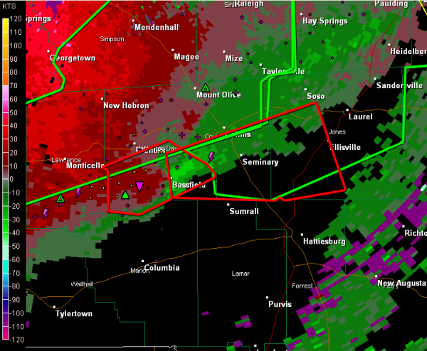
Debris Signature on Storm in South Mississippi
There is a dangerous storm over southern Mississippi tonight about 30 miles northwest of Hattiesburg. It shows strong indications of a tornado.
The most dangerous part of the storm is near Bassville community. The NWS Jackson see a debris signature now on the Doppler Radar. It will pass near or just south of Laurel in less than an hour.
These storms over southern Mississippi will eventually work into West Alabama’s Choctaw/Washington Counties, perhaps up into Marengo County. But the further east northeast they go, the instability that is quite rich over Mississippi will wane.
Right now the storms over southern Mississippi are being enhanced by very strong winds in the lower atmosphere.
Category: Alabama's Weather, Severe Weather


