

Heavy Rain Falling
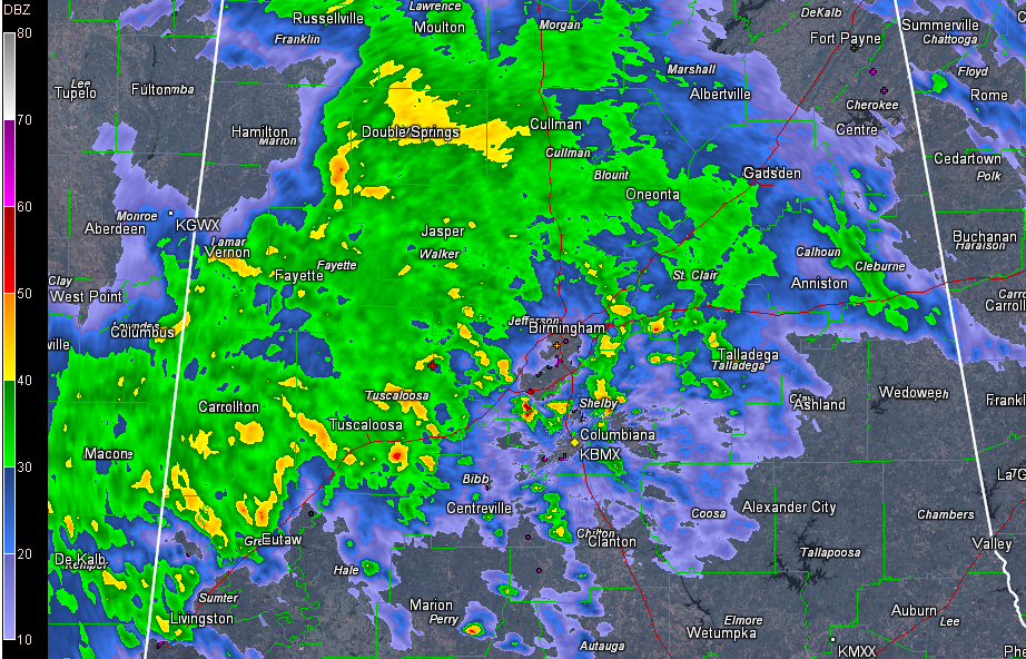
Snoopy started all of his novels with “it was a dark and stormy night.” That would be an appropriate description of tonight’s weather across the northwestern quarter of Alabama with a mass of heavy rain moving northeast and translating slowly east across the area.
Nothing severe, just heavy rain.
It is raining heavily now in places like Double Springs, Jasper, Fayette, Tuscaloosa and Carrollton. An areal flood advisory is in effect for Fayette, Lamar, Marion, Walker and Winston Counties until just before 11 p.m.
The rain has ended in Hamilton temporarily. But there will be more rain there overnight.
In the Birmingham area, heavy rain with lots of lightning and thunder from elevated storms that are over the Metro. There is some standing water on the sides of streets in the Birmingham area so be careful if you are out and about.
Back in Mississippi, there is a single tornado warning south of Jackson and north of Hazelhurst. These storms will run out of the area of severe potential before they get into Alabama. A tornado watch does continue until 11 p.m. for parts of southern Mississippi.
The rain will continue to push east across Central Alabama overnight. It will move out of the Birmingham area during the predawn hours.
NOTE FROM KANSAS CITY
The 8.3 inches of snow through 6 p.m. rates as the 7th highest February snow total since records began in 1888.
Category: Alabama's Weather, Severe Weather
About the Author (Author Profile)
Bill Murray is the President of The Weather Factory. He is the site's official weather historian and a weekend forecaster. He also anchors the site's severe weather coverage. Bill Murray is the proud holder of National Weather Association Digital Seal #0001 @wxhistorianSubscribe
If you enjoyed this article, subscribe to receive more just like it.


