Showers/Thunder Into Alabama
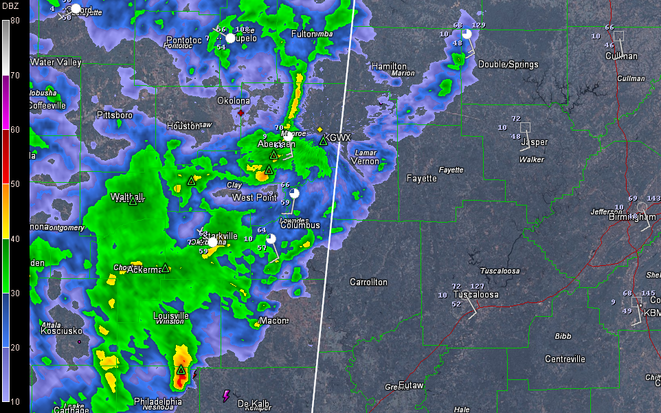
Showers and some thunder have pushed into Northwest Alabama from northeastern Mississippi this evening. Thunder was being reported in Marion and Lamar Counties with the showers there a short time ago. The electrical activity has pretty much disappeared now. There will be more later.
A cold front is pushing eastward across the Mississippi Delta tonight. Moisture is surging northward from the Gulf of Mexico ahead of the front. Increasing winds at about 5,000 feet should allow the activity to pick up in intensity over the next few hours over Mississippi. As moisture levels increase, the intensity of the rainfall will also increase.
The main activity will push into Alabama after midnight, but by then, it will begin to weaken into just a broad band of moderate to occasionally heavy rain with some embedded thunder through the pre-dawn hours as it moves across western Alabama, reaching the I-59 corridor around sunrise. No severe weather is expected.
It will continue to push across the state during the morning hours. The brunt of the rainfall will be east of I-59 by early afternoon, although it will take until late afternoon to get it out of Central Alabama.
The activity will intensify during the afternoon over southeastern sections of the state as a secondary low pressure system develops along the Gulf Coast. But the activity will be over by then.
Category: Alabama's Weather
About the Author (Author Profile)
Bill Murray is the President of The Weather Factory. He is the site's official weather historian and a weekend forecaster. He also anchors the site's severe weather coverage. Bill Murray is the proud holder of National Weather Association Digital Seal #0001 @wxhistorianSubscribe
If you enjoyed this article, subscribe to receive more just like it.


