Tonight into Easter
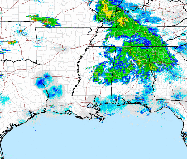
For the rest of tonight, most areas in North Central Alabama will continue to see some light to moderate rain for the next few hours. The rain should begin to taper off by later tonight and into the early morning hours. We can even see a few of the severe storms in Missouri and Oklahoma showing up in this radar image.
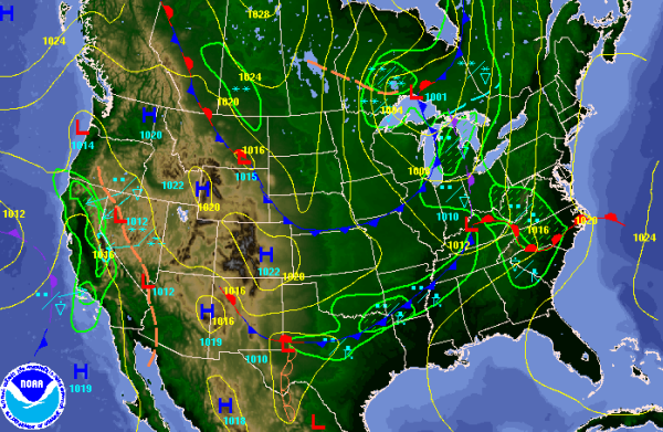
As we head into Easter Sunday, the weather will be very similar to today. The latest model runs continue to show the morning looking mostly dry, but there could be a few stray showers lingering around. Most of those sunrise services should be ok. Expect a mostly cloudy morning and we could even see a few peeks of sunshine in the morning. Clouds and additional showers and thunderstorms head our way by the afternoon. The forecast map below is very close to what I expect heading into tomorrow morning. Conditions look to be mostly dry, showers and thunderstorms will be off to our west. Cold front dropping to the southeast will be the focal point for the showers and thunderstorms tomorrow afternoon. May see a bit more in the way of thunderstorms tomorrow, but we are still not expecting any severe weather. The rain and storms will last into tomorrow evening and should last through much of tomorrow night.
The second front over northern Missouri will be dropping towards us will be the one that brings a different air mass to Alabama. Monday should be mostly dry and very warm, but the second front will cross the state and with it, much cooler air that will settle in for the mid part of the week.
Category: Alabama's Weather
About the Author (Author Profile)
Macon, Georgia Television Chief Meteorologist, Birmingham native, and long time Contributor on AlabamaWX. Stormchaser. I did not choose Weather, it chose Me. College Football Fanatic. @Ryan_StinnetSubscribe
If you enjoyed this article, subscribe to receive more just like it.


