Morning Radar Update
Most Easter sunrise services are going off without a hitch weather wise across Central Alabama this morning.
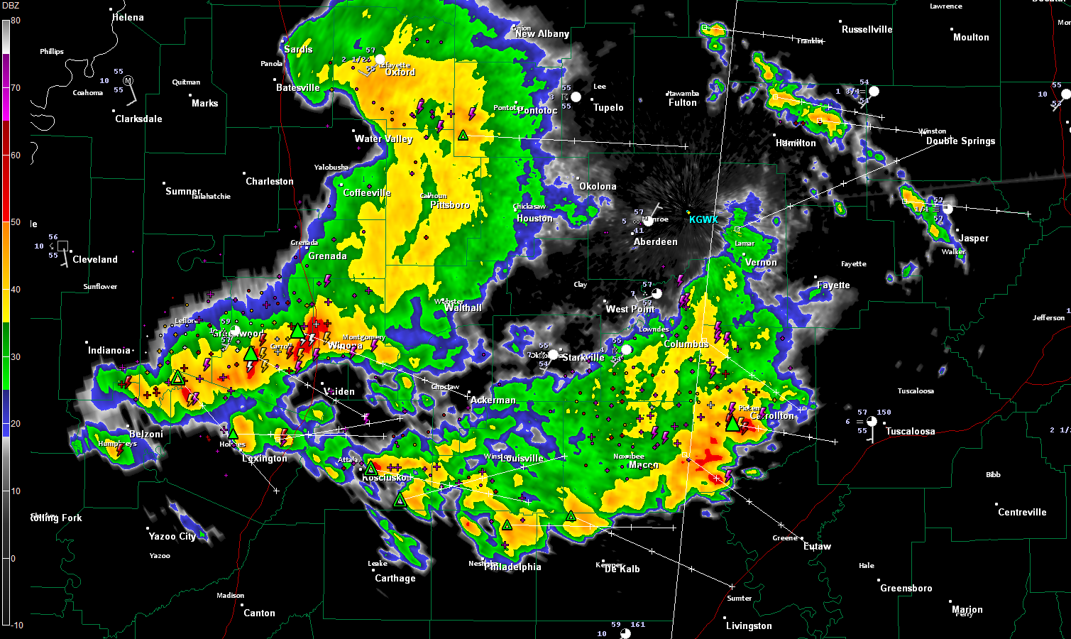
The exceptions are over Lamar and Pickens Counties where showers and storms were rumbling in from Mississippi and over parts of Marion, Winston and Walker Counties, where some lighter showers and storms were occurring.
The heaviest storm was just west of Carrollton in southere Pickens County. This cell had indications of half inch hail. Lots of lightning and thunder too. This activity was pushing southeast toward northern Sumter and Greene Counties and will brush the Tuscaloosa area as well.
Behind this, another complex of storms was over Central Mississippi. It has been accompanied by severe thunderstorm warnings which remain in effect just west of Winona. This activity will be into western Alabama’s Pickens, Greene and Sumter Counties between 8:30 and 9.
There could be isolated severe storms across the area today so pay attention to later weather information here on the blog. There is no formal risk in effect for Alabama, but that doesn’t mean there can’t be some severe weather.
There was fog in areas where skies cleared briefly last night, but clouds associated with the storms were moving back in at sunrise. Temperatures were in the 50s.
Brian will be posting the video and forecast discussion in minutes.
Category: Alabama's Weather, Severe Weather
About the Author (Author Profile)
Bill Murray is the President of The Weather Factory. He is the site's official weather historian and a weekend forecaster. He also anchors the site's severe weather coverage. Bill Murray is the proud holder of National Weather Association Digital Seal #0001 @wxhistorianSubscribe
If you enjoyed this article, subscribe to receive more just like it.


