Showers Struggle to Form
Click to enlarge the image.
LATE NOTE
The SPC has lifted the slight risk that affected northern and North Central Alabama on the 20Z issuance. There is just not sufficient wind shear for organized severe thunderstorms. Can’t rule out an isolated one forming this afternoon, but it doesn’t look likely.
ORIGINAL POST
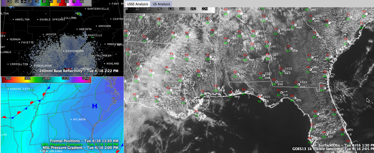
Looks and feels more like early June that April on this Tuesday afternoon across Central Alabama.
It is up to 81F at Birmingham with a dewpoint of 66. Tuscaloosa at 1 p.m. had 85F over 66F.
A nice cumulus field as in place across the area. The heating has resulted in unstable air across the area, with CAPE values running between 1250-1750 across the area, with some +2000 j/kg CAPEs around Montgomery.
You can see the surface observations and visible satellite imagery in the main panel of the image.
Low level temperature profiles are quite favorable for storms to develop, but the mid levels are more hostile. This is why you have seen storms have a hard time developing today. We watched a shower develop over Walker County. A it moved northeast into Blount County, it blossomed into a nice little shower. Tops never got much above 20,000 feet though, and I didn’t see any lightning. Areas north of Nectar and Cleveland got a nice downpour, but it died before it got to Susan Moore and Snead.
Same thing around Cullman and Vinemont around 1:20. A healthy shower developed then collapsed before it could become a storm.
Some heavy showers are trying to develop over southern Shelby County, over into Talladega Couny. Another is near Ragland.
You can see the current NWS BMX radar reflectivity in the top left panel.
The surface pressure pattern and fronts are in the lower left panel. The high pressure to our east is flexing its msucles, sending moist southeasterly flow into Alabama.
We will continue to monitor the radar through the afternoon watching for showers to grow into storms. Wind shear parameters are not very impressive, there could be just enough for storms that do form to get some organization. Damaging winds and hail are the main threat as there is just not enough helicity for tornadoes.
A subtle ridge in the atmosphere that is pushing out of Alabama into Mississippi may allow the flow aloft to become more northwesterly as we go through the afternoon though. This could introduce a tad more helicity later today, according to Kevin Laws at the NWS.
We will be watching.
Category: Alabama's Weather, Severe Weather
About the Author (Author Profile)
Bill Murray is the President of The Weather Factory. He is the site's official weather historian and a weekend forecaster. He also anchors the site's severe weather coverage. Bill Murray is the proud holder of National Weather Association Digital Seal #0001 @wxhistorianSubscribe
If you enjoyed this article, subscribe to receive more just like it.


