

Current Storm to Watch
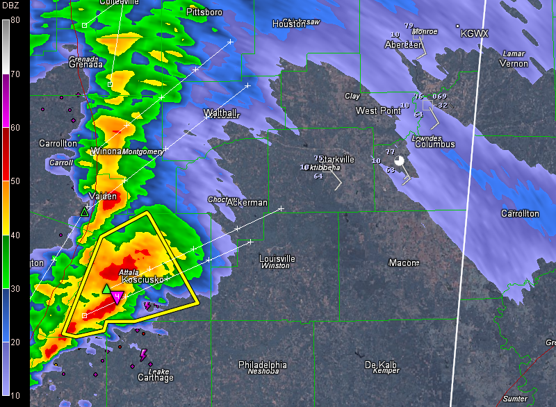
The storm that produced a brief tornado in western Mississippi and prompted several tornado warnings before weakening over the past 75 minutes is ramping up again, about two hours southwest of Columbus.
It has the only severe thunderstorm warning in the country right now.
The NWS is watching it closely. Lightning output has ramped up dramatically. Rotation is increasing, even at the lower levels. It could trigger a new tornado warning shortly.
The storm is approaching Kosciusko in Attalla County. It will approach the Starkville area before 9 and Columbus around 9:30.
It will be into Pickens or Lamar Counties around 10 p.m.
Category: Alabama's Weather, Severe Weather
About the Author (Author Profile)
Bill Murray is the President of The Weather Factory. He is the site's official weather historian and a weekend forecaster. He also anchors the site's severe weather coverage. Bill Murray is the proud holder of National Weather Association Digital Seal #0001 @wxhistorianSubscribe
If you enjoyed this article, subscribe to receive more just like it.


