

Slight Risk Outlook Continues for Alabama
The SPC has dramatically trimmed the Day One slight risk outlook area to just include parts of southern Tennessee, eastern Mississippi and much of Alabama.
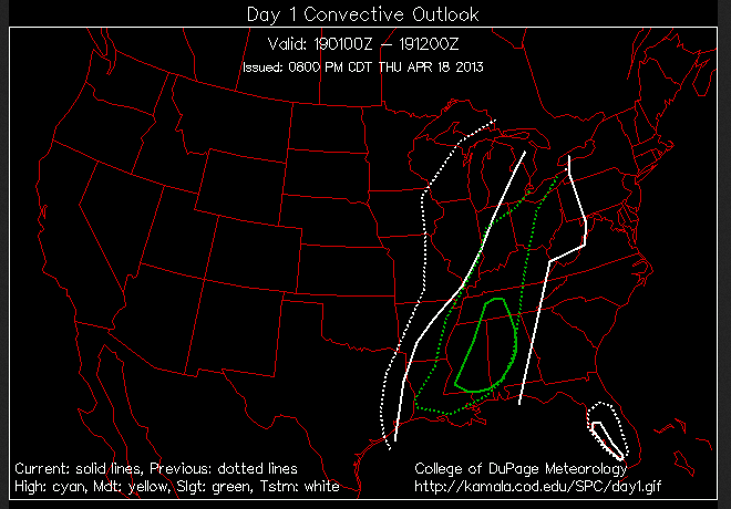
The northeastern corner of Alabama has been removed.
You can see the new slight risk area outlined in solid green. The previous outlook is show in dotted green.
The white lines are the thunderstorm outlook.
Instability levels across Alabama are low and are not expected to increase much. But they aren’t supposed to drop substantially either. Wind profiles are sufficient for severe thunderstorms, so we will continue to monitor the storms as they come into the state. We are currently watching a severe storm in the Kosciusko area that will be approaching Columbus MS between 9 and 9:30.
The main threat for severe weather will be over northwestern counties, for Pickens through Fayette, Walker and Cullman Counties and points north and west.
All of the storms will weaken later tonight as the main dynamics lift out to the northeast.
Category: Alabama's Weather, Severe Weather
About the Author (Author Profile)
Bill Murray is the President of The Weather Factory. He is the site's official weather historian and a weekend forecaster. He also anchors the site's severe weather coverage. Bill Murray is the proud holder of National Weather Association Digital Seal #0001 @wxhistorianSubscribe
If you enjoyed this article, subscribe to receive more just like it.


