Instability Increasing, So Are the Showers
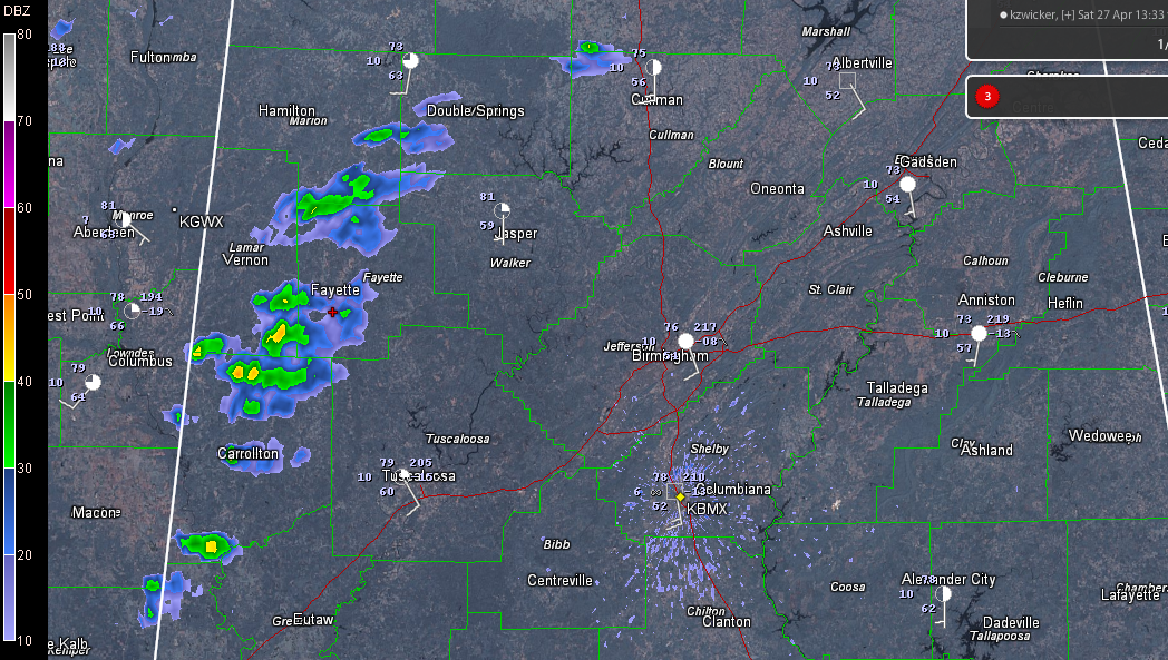
Showers that are destined to be thunderstorm soon have formed over western Alabama in an area of increasing instability where sunshine is working on moisture that is entering the state from Mississippi. Here is the radar:
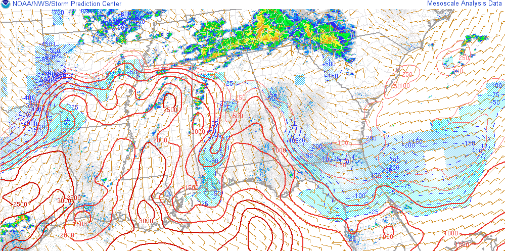
Here is the SPC meso page showing the instability values.
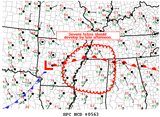
LATE NOTE: The SPC just issued a mesoscale discussion for northern Mississippi, eastern Arkansas, southwestern Tennessee and northwestern Alabama for developing storms, some of which will become severe later today to the west. Tornadoes are even possible to the north near the warm front. Look for a severe thunderstorm or tornado watch later for parts of the scalloped area.
ORIGINAL POST:
The good news is, this development completely supports the new forecast package just posted on AlabamaWX.com. Here are the excerpts for this afternoon, tonight and tomorrow.
LIFT, MOISTURE: That is the recipe for some spring thunderstorms over the next couple of days across Central Alabama. But not much wind shear. The lack of shear will preclude an organized episode of severe weather, but a few strong to severe storms will still occur over the next 36 hours across the area. Let’s try to pin down when and where the storms will be, and just how strong they will get.
SEARCHING FOR CLUES: The situation across Alabama and the Deep South is a little muddled on this Saturday afternoon, so one has to look a little harder for clues as to what the next 36 hours entail. Near the ground, we find a surface low over western Arkansas, being energized by an upper level disturbance that swung out of Oklahoma overnight. The combination was pulling Gulf moisture northward behind a warm front that lies along the border between Tennessee and Mississippi and Alabama early this afternoon. There was a healthy area of rain and storms north of this front during the morning hours. Nothing severe, but some flash flood warnings were required for some counties in western Tennessee.
REST OF THE AFTERNOON: Moisture levels will rise into to the 60s across Central Alabama this afternoon as Gulf moisture floods into from Louisiana and Mississippi. Sunshine was increasing, especially in areas west of I-65 as we approached the noon hour. This means that instability levels will be increasing through the afternoon hours, with instability levels nearing 1,500-2,000 joules/kg in pockets. Most of the afternoon should be rain free as a bit of a ridge in the upper atmosphere keeps a lid on things. That will change starting around mid-afternoon however, as the surface low starts to approach Memphis from the southwest. Showers and storms will break out in the unstable air from Mississippi into northwestern Alabama. We could see a strong storm or two in places like Hamilton, Double Springs, Jasper, Fayette and Vernon before sunset. Highs will be in the upper 70s in most most places.
OVERNIGHT: The threat for strong to even severe thunderstorms will continue into the evening hours as the low drags a cold front into northern Mississippi. The storms should affect mainly areas northwest of and along I-59, lifting into the Tennessee Valley as we move toward midnight. But more storms will form later tonight as the upper level trough to our northwest begins to strengthen and the cold front makes a stronger push toward the state. Its progress will be slow, impeded by a blocking high pressure system to the east, but you can look for increasing rain and storms during the pre-dawn hours. Overnight lows will be hard pressed to drop below 60F.
SUNDAY: It now looks like the best chances for rain and storms will come on Sunday as the upper level feature begins to flex its muscle and wins the tug of war with the high, pushing the flag (the front) through Alabama. Periods of shower and storms will be a good bet until the front clears your area, starting in northwestern sections during the morning, in areas along I-59 during the early afternoon and by evening in southeastern sections. Rainfall amounts tomorrow are expected to average around ½ inch, with some one inch amounts over the Northeast corner of the state. Totals for today and Sunday will average an inch in the I-20 corridor, with greater amounts to the north and lesser amounts to the south. Highs will be in the 70s.
Category: Alabama's Weather, Severe Weather
About the Author (Author Profile)
Bill Murray is the President of The Weather Factory. He is the site's official weather historian and a weekend forecaster. He also anchors the site's severe weather coverage. Bill Murray is the proud holder of National Weather Association Digital Seal #0001 @wxhistorianSubscribe
If you enjoyed this article, subscribe to receive more just like it.


