Slight Risk Expanded, Storms Growing
New Storm Prediction Center Day One severe weather outlook is out and it shows a slightly expanded slight risk area over Alabama.
A “slight” risk is the standard severe weather forecast from the SPC. It is issued when organized severe thunderstorms are foercast for an area.
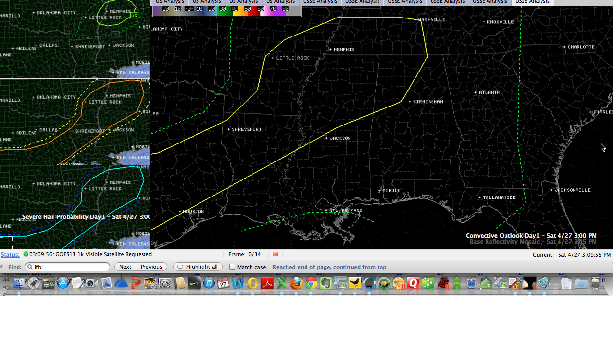
The right panel shows the categorical risk area with the counties underlaid. The left panels from top to bottom show the probabilities of a tornado (5% in solid green), damaging winds (15% in orange) or large hail (1 inch or larger, 15% in aqua) within 25 miles of a point.
Here is a drilled down look at the areas covered by the categorical slight risk and the 5% tornado probability across western Alabama.
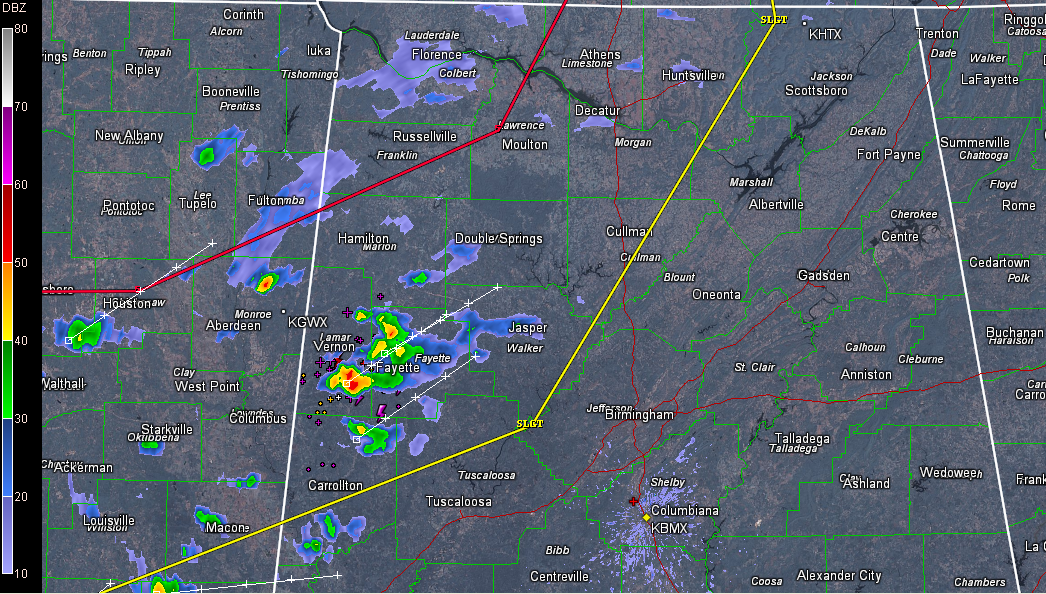
So there is a risk of severe weather tonight, mainly northwest of a line from roughly Carrollton to Gorgas to Cullman to Gurley. The biggest threat is damaging winds and large hail, with a smaller risk of a tornado over the northwestern part of the state around Florence and Russellville.
A weather watch is likely later and there will undoubtedly be warnings later, so keep one eye on the weather for the rest of the day and tonight.
Current radar shows storms developing over western Alabama, with the strongest ones right now in Lamar and Fayette Counties, primarily between Vernon and Fayette. Movement is northeast at 35-40 mph.
SOME GOOD NEWS
The end of the week looks colder, but not nearly as cold as we have been warning, according to the morning run of the GFS. Still bears watching however, and upper 30s to lower 40s are still possible Saturday morning.
Category: Alabama's Weather, Severe Weather
About the Author (Author Profile)
Bill Murray is the President of The Weather Factory. He is the site's official weather historian and a weekend forecaster. He also anchors the site's severe weather coverage. Bill Murray is the proud holder of National Weather Association Digital Seal #0001 @wxhistorianSubscribe
If you enjoyed this article, subscribe to receive more just like it.


