

Mid-Morning Update
ON THE MAPS: Area of low pressure with a trailing cold front continues to cause unsettled weather across the Southeast and the state of Alabama. The cold front continues to lift the warm moist air across the south and is causing shower and thunderstorm development. Instability values are approaching 1500 J/kg over central Alabama. Luckily, cloud cover in place will prevent further destabilization of the atmosphere over the state.
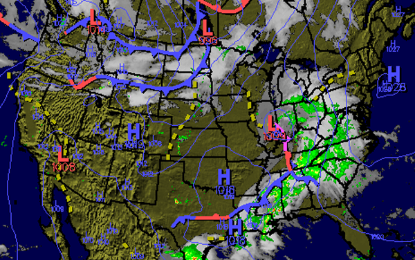
RADAR CHECK: Showers and thunderstorms continue to spread across the state this morning. We are seeing storms develop into more of a linear features along the front that is now entering northwest portions of Alabama. Storms have been intensifying the last few hours and could be producing gusty winds and hail. Storms are not expected to reach severe limits, but there could be an isolated severe thunderstorm capable of producing large hail and damaging winds. Dangerous lightning and heavy rainfall are accompanying these storms.

WHAT TO EXPECT: We are in a moist unstable air mass and until the front passes through, the showers and storms will continue. The front along with other mesoscale outflow boundaries are producing uplift and are the focal points for thunderstorms development. Storms for the most part should remain below severe limits. We will be watching for the possibility of flooding as well as some areas have received 1-2 inches of rain with the activity overnight. Precipitable water values remain greater than an inch. Showers and storms will last through the afternoon.
Category: Alabama's Weather
About the Author (Author Profile)
Macon, Georgia Television Chief Meteorologist, Birmingham native, and long time Contributor on AlabamaWX. Stormchaser. I did not choose Weather, it chose Me. College Football Fanatic. @Ryan_StinnetSubscribe
If you enjoyed this article, subscribe to receive more just like it.


