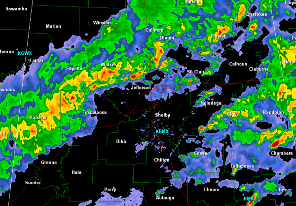
Line of Storms Slowly Dropping South
The strong line of storms are now making their way into Jefferson and Tuscaloosa Counties. Storms are still currently non-severe, but they are capable of producing very intense rainfall, small hail and gusty winds. Heavy rain is falling from Gordo, to Samantha, Morris, Clay and up to Gadsden. These storms are currently along the cold front that continues to drop south through the state today.
Interstate 65 north of Birmingham is already being impacted, and the Interstate 20/59 corridor looks as though it will be wet for the next several hours.
Heavier storms continue across our southeastern areas as well. Chamber, Randolph and Clay Counties are seeing intense downpours currently. The rain has ended for areas in the northwest part of the state in Marion, Winston and northern Lamar Counties and the cities of Sulligent, Hamilton and Double Springs are beginning to dry out.
Category: Alabama's Weather


