Early Morning Update
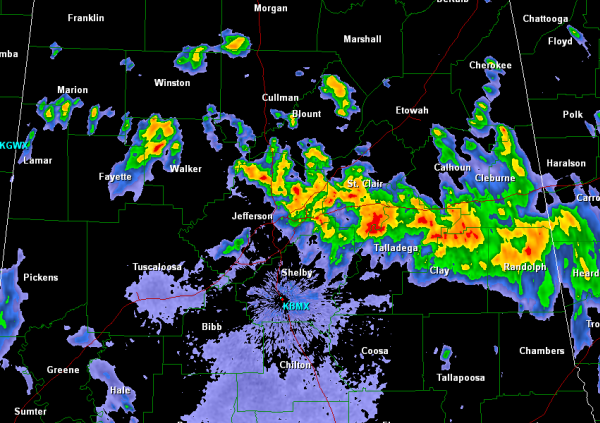
The severe weather threat for Alabama diminished during the late evening hours yesterday, but showers and thunderstorms continue to develop along a boundary that is draped across the area. Though no storms in Alabama have bee severe the last few hours, there is a serious flooding threat that has developed across areas of Central and East Alabama. The most intense showers and storms are along and south of Interstate 20 from the Georgia state line back west to eastern portion of Birmingham. Additional storm are ongoing northwest of the city of Jasper as well and look to be impacting Corridor X.
Flash flooding is becoming a great concern from portions of Jefferson County east along the Interstate 20 corridor as several inches of rain have fallen and several more are expected too. Storms are training along the same areas dropping very heavy rain. Very serious situation is developing as the rain continues to fall in areas that are already seeing impassible roads because of rising water.
Additional showers and storms continue to develop across East-Central Mississippi and these are expected to move into West Alabama as head through the morning as well. The unsettled weather is expected to hang around Alabama through the day on Saturday before high pressure will move in for Sunday.
Category: Alabama's Weather
About the Author (Author Profile)
Macon, Georgia Television Chief Meteorologist, Birmingham native, and long time Contributor on AlabamaWX. Stormchaser. I did not choose Weather, it chose Me. College Football Fanatic. @Ryan_StinnetSubscribe
If you enjoyed this article, subscribe to receive more just like it.


