Severe Weather Risk for NW Alabama
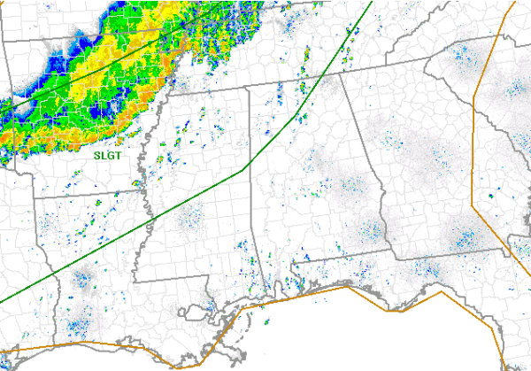
The latest day one convective outlook has the SPC maintaining portions of northwest Alabama in a slight risk for severe weather. The risk does not include Birmingham, Tuscaloosa, Anniston or Gadsden, but does include Huntsville, Fayette, Hamilton, Haleyville and Muscle Shoals.
Showers and thunderstorms continue this mid day along a boundary to our north and northwest. Several severe thunderstorm warnings are ongoing in the Memphis area as well as widespread reports of flash flooding. As this band of storms continues to drop south today, a very warm, unstable air mass is in place ahead of it. Daytime heating will lead to further destabilization of the boundary layer. This will allow for some re-intensification of storms in the complex as well as allow for showers and storms to develop ahead of it. Main threats will be large hail and damaging winds. Flooding could pose a substantial threat as well.
Category: Alabama's Weather, Severe Weather
About the Author (Author Profile)
Macon, Georgia Television Chief Meteorologist, Birmingham native, and long time Contributor on AlabamaWX. Stormchaser. I did not choose Weather, it chose Me. College Football Fanatic. @Ryan_StinnetSubscribe
If you enjoyed this article, subscribe to receive more just like it.


