Mid-Afternoon Update
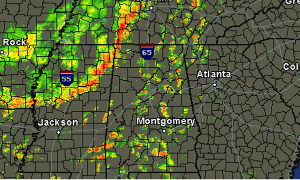
Showers and thunderstorms continue to develop across much of the state and Southeast this afternoon. Scattered showers have popped up over Alabama, while a line of showers and storms continues to push into Northwest Alabama from Mississippi. The SPC maintains a slight risk for our northwestern counties, but have come off the severity that is expected. Hail and damaging winds can still occur with any storms today. The most intense activity is now making it into Northwest Alabama and should continue to drop to the southeast over the next few hours.
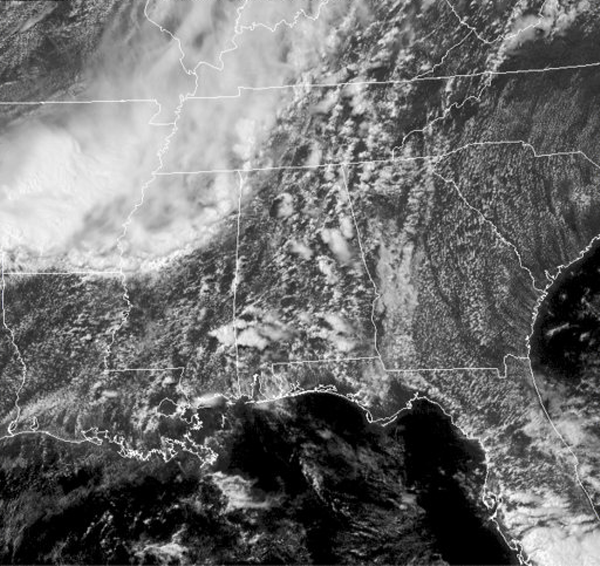
Satellite shows a mix of clouds and sun across the state. Over in Mississippi, you can also see the higher cloud tops with some of those stronger storms that are heading this way. At this point, no storms in the state or in the line that is entering Alabama are at severe limits. That could change at anytime as these storms were severe earlier this morning in the Memphis area.
Category: Alabama's Weather
About the Author (Author Profile)
Macon, Georgia Television Chief Meteorologist, Birmingham native, and long time Contributor on AlabamaWX. Stormchaser. I did not choose Weather, it chose Me. College Football Fanatic. @Ryan_StinnetSubscribe
If you enjoyed this article, subscribe to receive more just like it.


