Showers and Storms
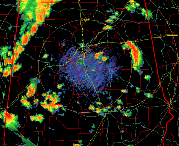
A quick look at the radar this evening shows a line of showers and thunderstorms moving east across portions of North Alabama. Areas from Reform to Fayette up to Haleyville are seeing some of the more intense activity. No storms are currently severe and hopefully we will not see any storm reach severe limits. Some of these storms are producing some lightning with gusty winds and possibly some small hail
There are a few clusters of heavier storms ahead of this line. Areas near Anniston and Oxford down through eastern Clay County, as well as areas from Sumter County towards Demopolis, Marion and over towards Prattville are seeing some heavy rain and gusty winds. These showers and storms will last through the evening hours and into the overnight hours.
Category: Alabama's Weather
About the Author (Author Profile)
Macon, Georgia Television Chief Meteorologist, Birmingham native, and long time Contributor on AlabamaWX. Stormchaser. I did not choose Weather, it chose Me. College Football Fanatic. @Ryan_StinnetSubscribe
If you enjoyed this article, subscribe to receive more just like it.


