

Afternoon Update
It is not a bad looking afternoon across much of the state and especially Central Alabama. All areas remain dry, but clouds are hanging tough in many areas. These clouds are mostly in the lower layers of the atmosphere and are located in several saturated layers.
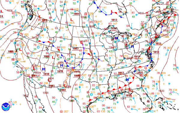
Looking at the state as a whole, you can see a boundary is in place across the Wiregrass region stretching west into southwest Alabama. This boundary is the main focal point for scattered showers and thunderstorm this afternoon. It was stationary earlier today, but has since slowly started moving north as a warm front.
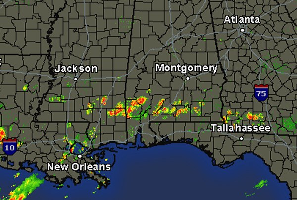
A quick look at the regional radar shows activity has developed and is moving to the north with the warm front. This front will be making its way into our region overnight and will lead to and increase in shower and thunderstorm activity on Sunday. If these storms hold together, they will be affecting some of our southern counties later this afternoon and evening. We will have to watch them carefully, to see how far north these storms will make it.
Category: Alabama's Weather
About the Author (Author Profile)
Macon, Georgia Television Chief Meteorologist, Birmingham native, and long time Contributor on AlabamaWX. Stormchaser. I did not choose Weather, it chose Me. College Football Fanatic. @Ryan_StinnetSubscribe
If you enjoyed this article, subscribe to receive more just like it.


