

For the Rest of the Evening
Over the last few hours, showers and thunderstorms have developed to our south along a warm front that is slowly lifting north. Southerly flow aloft is blowing the cloud tops from these storms into Central Alabama. For this reason, clouds have been increasing from south to north across the area this evening. Most locations saw afternoon highs in the 80s. Dew points are beginning to rise as well and that means showers and storms will be on the increase, especially tomorrow.
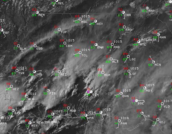
Not expecting to much in the way of rain tonight. A few isolated storms could still be possible, but most areas will remain dry. The exceptions should be our southern counties, where some showers have made it as far north as the U.S. Highway 80 corridor. These showers are struggling to maintain themselves once they make it to Central Alabama, so I think most locations will have a rain free evening. The current convection should begin to wind down once the sun sets. For our area, it should be pretty nice evening and not a bad night on tap if you have any plans. The weather should certainly not be an issue across the Birmingham Metro

Category: Alabama's Weather
About the Author (Author Profile)
Macon, Georgia Television Chief Meteorologist, Birmingham native, and long time Contributor on AlabamaWX. Stormchaser. I did not choose Weather, it chose Me. College Football Fanatic. @Ryan_StinnetSubscribe
If you enjoyed this article, subscribe to receive more just like it.


