

Late Night Radar Check
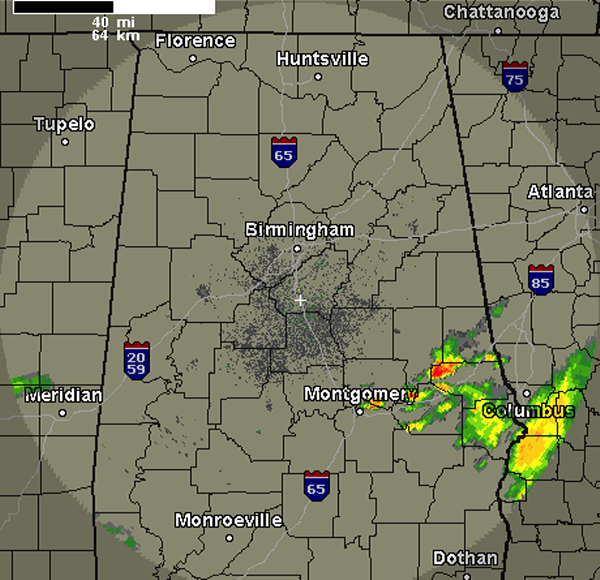
It remains calm across much of the region tonight. We do have a few showers and storms across our southeastern counties along the Interstate 85 corridor. This activity is impacting areas from Montgomery to Auburn. No severe storms, but these storms could have some gusty winds along with intense rain. This convection was lifting north and northeast with a warm front that is moving back north tonight.There are a few showers across Central Mississippi tonight too.
Heading through the overnight hours, we could see a few showers and thunderstorms make it into Central Alabama as the front lifts north. Showers and storms were moving onshore along the Gulf Coast and as the warm, moist air mass streams north, we could see this activity make it into our area. Tomorrow will be an active day as widespread showers and thunderstorms are expected across much of the state. We will have to keep an eye on a chance for isolated flash flooding in some areas tomorrow.
Category: Alabama's Weather
About the Author (Author Profile)
Macon, Georgia Television Chief Meteorologist, Birmingham native, and long time Contributor on AlabamaWX. Stormchaser. I did not choose Weather, it chose Me. College Football Fanatic. @Ryan_StinnetSubscribe
If you enjoyed this article, subscribe to receive more just like it.


