

Early Afternoon Radar Check
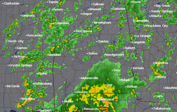
Over the last few hours we have seen a rapid development of showers and some thunderstorms across Alabama. A very moist air mass in place, along with daytime heating and some upper-level forcing have allowed for widespread convective activity. All showers are moving rapidly off to the north. Some of the most intense activity currently is along Interstate 20/59 from Mississippi up into the Birmingham Metro. A lot of this activity is hit or miss this afternoon, and if you are not seeing any rain at your location now, odds are you will later as showers should continue to develop and expand in coverage the rest of the afternoon.
Farther to the south, strong storms with very heavy rain are affecting the Gulf Coast. There have even been a few severe thunderstorm warnings with some storms moving onshore from the Gulf. Damaging winds look to be the greatest concern with these storms.
Category: Alabama's Weather
About the Author (Author Profile)
Macon, Georgia Television Chief Meteorologist, Birmingham native, and long time Contributor on AlabamaWX. Stormchaser. I did not choose Weather, it chose Me. College Football Fanatic. @Ryan_StinnetSubscribe
If you enjoyed this article, subscribe to receive more just like it.


