

Midday Outlook
There have been a few areas of showers and thunderstorm that have impacted portions of Central Alabama this morning, but most of this activity has moved out of the area. We have seen a substantial break in the clouds especially over portions of west Alabama. This will be very short-lived as showers are already beginning to develop in this area. If you look along the Gulf Coast, a large mass of clouds has developed along the coast and adjacent waters. There is quite a bit of shower and thunderstorm activity with these clouds. It is slowly moving onshore and lift off to the northeast.
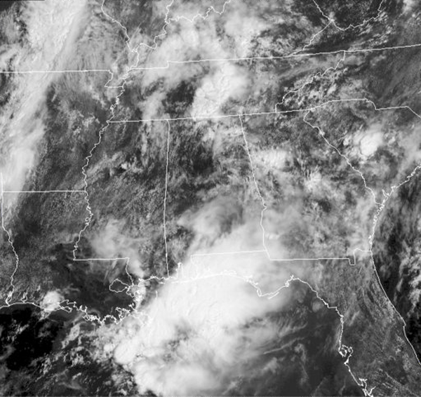
Looking at the regional radar, we can see the activity along the coast. We can also see the scattered activity across the rest of the southeast. As we continue through the afternoon and evening, the radar will be filling in as widespread convection will develop over the next few hours. Severe weather is not expected, but there could be a few strong storms this afternoon. The main concern with these downpours will be a threat for some isolated flash flooding. We do have a very warm, moist atmosphere in place across the state, but it will be interesting to see if the activity along the Gulf Coast hampers development farther inland today. Storms are going to develop but we will have to wait and see to what extent.

Category: Alabama's Weather
About the Author (Author Profile)
Macon, Georgia Television Chief Meteorologist, Birmingham native, and long time Contributor on AlabamaWX. Stormchaser. I did not choose Weather, it chose Me. College Football Fanatic. @Ryan_StinnetSubscribe
If you enjoyed this article, subscribe to receive more just like it.


