

Watching Storms to our West
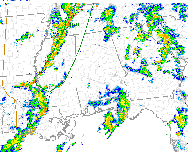
Most of Alabama saw a soaking rain today. A very moist air mass in place provided ample fuel for showers and thunderstorms that developed and rapidly moved north today. Most of the activity from today has dissipated the last few hours as the sun has set.
To our west, a line of thunderstorms were moving across northern Mississippi and western Tennessee. This line of storms has had a history of producing severe weather. These storms could be impacting portions of Northwest Alabama overnight, with the threat for some hail and damaging winds. Not expecting anything too significant as these storms should begin to weaken slowly as the the sun sets and we lose daytime heating. We will be watching them as they approach the state, but the Storm Prediction Center has issued a slight risk for severe weather for some of our northwestern counties. Areas of Lamar, Marion, Franklin, Colbert and Lauderdale Counties are included in this risk.
Category: Alabama's Weather, Severe Weather
About the Author (Author Profile)
Macon, Georgia Television Chief Meteorologist, Birmingham native, and long time Contributor on AlabamaWX. Stormchaser. I did not choose Weather, it chose Me. College Football Fanatic. @Ryan_StinnetSubscribe
If you enjoyed this article, subscribe to receive more just like it.


