

Late Night Radar Check
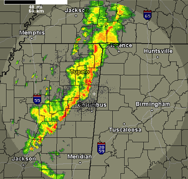
A line of thunderstorms is about to cross the state line from Mississippi. These storms have been severe during their track across northern Mississippi, but that have been weakening the last several hours. Currently, none of the storms are severe and the models actually show that these storms will continue to weaken as they head into the state.
The storms will impact portions of Alabama. We can expect some gusty winds, small hail, frequent lightning, very heavy rains and some loud rumbles of thunder. Not expecting these storms to reach severe limits and once again they are expected to continue to weaken the next few hours. Areas from Highway 82 in Pickens County north to the Tennessee state line could be impacted by this line over the next few hours. If this activity were to hold together it could be affecting the Interstate 65 corridor and Birmingham Metro during the early morning hours.
Across the rest of the state, all other shower activity has dissipated and this line of storms is the only thing grabbing our eyes tonight.
Category: Alabama's Weather
About the Author (Author Profile)
Macon, Georgia Television Chief Meteorologist, Birmingham native, and long time Contributor on AlabamaWX. Stormchaser. I did not choose Weather, it chose Me. College Football Fanatic. @Ryan_StinnetSubscribe
If you enjoyed this article, subscribe to receive more just like it.


