Severe Weather Threat Across North Alabama
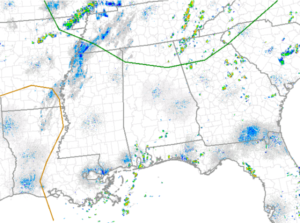
The latest day one convective outlook issued by the SPC now has portions of northern Alabama outlined in the standard slight risk. For Alabama the risk area runs from Franklin County on the west side of the state, east into Winston, Cullman, Blount, Etowah, Cherokee Counties. Areas north of this line could see a threat from severe storms today.
A very moist air mass is in place across much of the eastern half of the U.S. Daytime heating will lead to destabilization of the atmosphere and showers and thunderstorms are beginning to develop. The best dynamics for severe weather today are across Kentucky and Tennessee. A complex of thunderstorms currently across southern Illinois and northern Kentucky are continuing to move southeastward today. With such an unstable atmosphere in place, these storms are expected to maintain and actually increase in intensity through out the afternoon. By later this evening, these storms could be impacting areas across the Tennessee Valley and for this reason, the SPC has included that portion of Alabama in the latest risk issued. The main severe weather threat with these storms will be damaging winds. There could be some hail and flooding associated with these storms and of course dangerous and frequent lightning.
Category: Alabama's Weather, Severe Weather
About the Author (Author Profile)
Macon, Georgia Television Chief Meteorologist, Birmingham native, and long time Contributor on AlabamaWX. Stormchaser. I did not choose Weather, it chose Me. College Football Fanatic. @Ryan_StinnetSubscribe
If you enjoyed this article, subscribe to receive more just like it.


