Late Night/Early Morning Storms Possible
**No afternoon Weather Xtreme video today…. I am at the AMS Conference on Broadcast Meteorology in Nashville today and tomorrow… busy with sessions this afternoon**
RADAR CHECK: At 2:45 this afternoon I see just one very small shower near Riverside (east of Pell City); most of the state is dry with a partly sunny sky and temperatures 88-92 degree range.
TO THE NORTH: Let’s keep an eye on these storms nearing Louisville, KY…
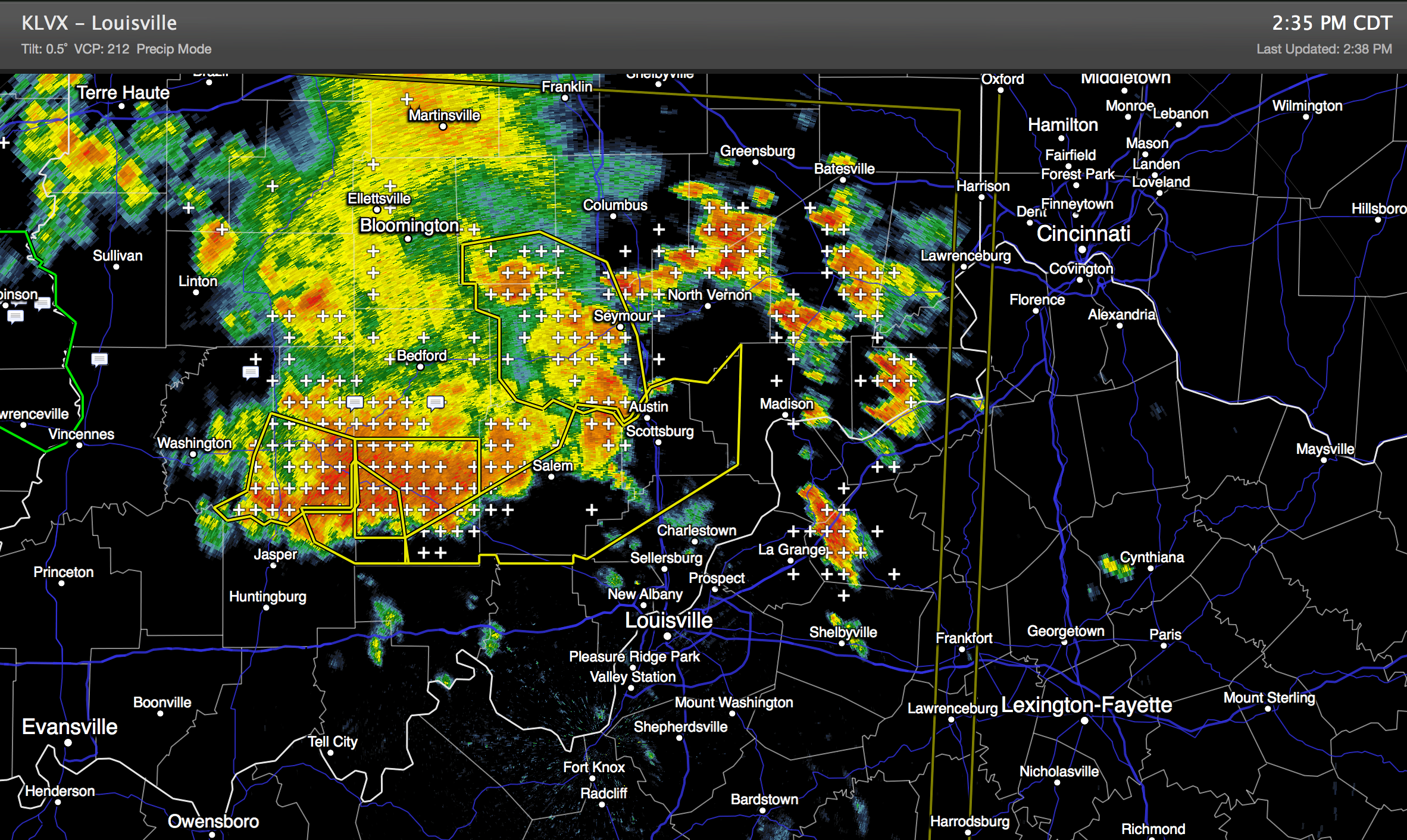
This cluster of storms is expected to hold together as it moves southward through Tennessee tonight, and these storms should enter far North Alabama after midnight. Below is the WRF-NMM output valid at 5 a.m. CT early tomorrow..
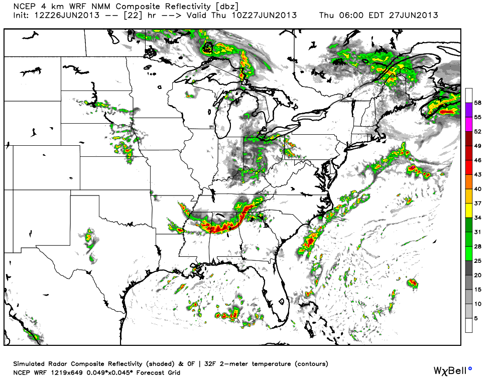
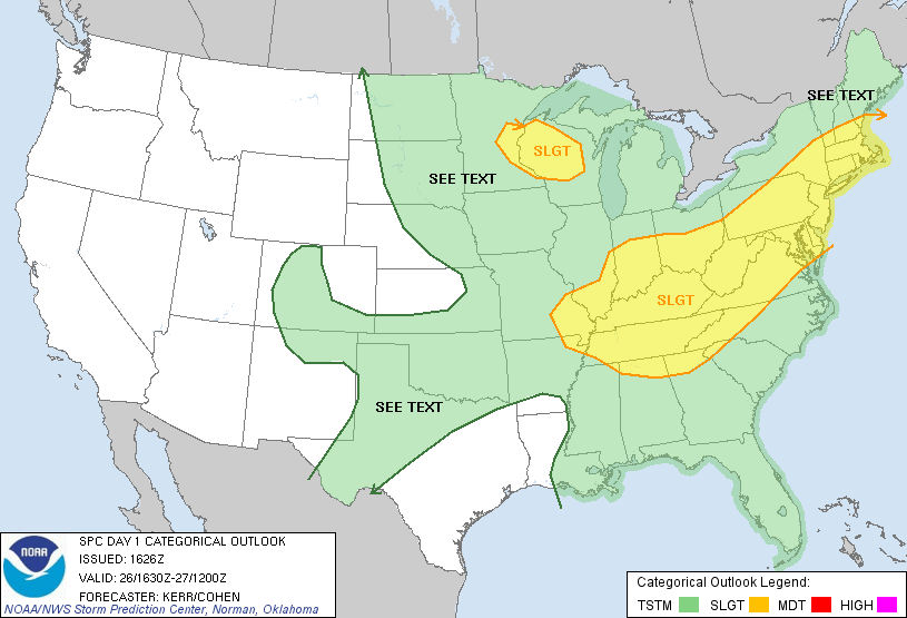
This is suggesting the storms could hold together all the way down to I-20, with potential for high winds. But, other models show the line weakening greatly once it moves into Alabama after midnight. We do note SPC has put far North Alabama in the standard “slight risk” of severe weather for late tonight and early tomorrow…
We will just have to keep an eye on radar overnight, but those of you over the Tennessee Valley will need to pay attention in the 11 p.m. to 3 a.m. time frame.
More than likely, the best chance of showers and storms will shift down into South Alabama tomorrow afternoon near the outflow of the morning storms. A decent chance much of tomorrow afternoon will be dry over the northern half of the state, although in this airmass you just can’t rule out a shower or storm in a few spots.
FRIDAY AND THE WEEKEND: The challenge of forecasting intensity, coverage, placement, and timing of summer showers and storms is full play with inconsistent model output. Looks like we will to mention scattered to numerous showers and storms Friday and Saturday with a surface front slowly approaching from the north, and an upper trough forming over the eastern third of the nation. There will be intervals of sun, and the high both days will be in the 88-91 degree range. Showers could very well be fewer in number Sunday as drier air tries to enter North Alabama, but we will still need to mention at least some risk of a shower in spots.
NEXT WEEK: The first half of the week looks relatively wet with occasional showers and storms Monday through Wednesday thanks to the upper trough over the eastern half of the nation. Temperatures will be below average for early July, with highs mostly in the mid to upper 80s.
GULF COAST WEATHER: We project a general amount of 6 to 8 hours of sunshine each day through Sunday from Panama City to Gulf Shores; scattered showers and storms will be around each day as well. Highs along the immediate coast will be in the upper 80s, and sea water temperatures are in the low to mid 80s. Looking ahead to next week and the Fourth of July holiday, we might have to mention increasing coverage of showers and storms with lesser amounts of sunshine as tropical moisture levels rise.
WEATHER BRAINS: Don’t forget you can listen to our weekly 90 minute netcast anytime on the web, or on iTunes. This is the show all about weather featuring many familiar voices, including our meteorologists here at ABC 33/40.
CONNECT: You can find me on all of the major social networks…
Facebook
Twitter
Google Plus
Instagram
Look for the next Weather Xtreme video here by 7:00 a.m. tomorrow….
Category: Alabama's Weather
About the Author (Author Profile)
James Spann is one of the most recognized and trusted television meteorologists in the industry. He holds the AMS CCM designation and television seals from the AMS and NWA. He is a past winner of the Broadcast Meteorologist of the Year from both professional organizations.Subscribe
If you enjoyed this article, subscribe to receive more just like it.


