

For this Evening
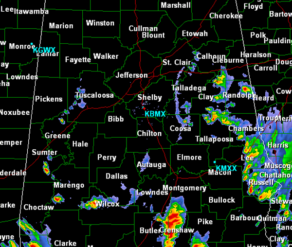
Showers and storms continue to move from east to west across the state this evening. Today most of the activity has been along and south of Interstate 20 today.
Currently, the more intense activity is stretching from Clay County, down through Chambers, Lee and Russell Counties. There are also stronger storms affecting Crenshaw, Butler and Lowndes Counties. Storms are producing frequent lightning and very heavy rain. Storms will continue to move to the west over the next few hours. Additional showers and storms may develop through out the evening across Central Alabama and like all the other storms will track towards the west. Showers and storms could last through the overnight hours as a very moist air mass is in place across the state and is providing ample fuel for convective activity.
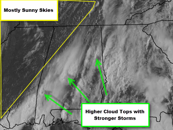
Much of Central Alabama had mostly sunny skies today but once storm began to develop this afternoon, the tops of these storms blew off of the storms and have produced mostly cloudy skies for much of Central Alabama. The northwestern corner of the state is the only place in the state still seeing mostly sunny skies this evening.
Expect the cloud cover to continue to spread west with the showers and thunderstorms that will continue to progress that direction.
Category: Alabama's Weather
About the Author (Author Profile)
Macon, Georgia Television Chief Meteorologist, Birmingham native, and long time Contributor on AlabamaWX. Stormchaser. I did not choose Weather, it chose Me. College Football Fanatic. @Ryan_StinnetSubscribe
If you enjoyed this article, subscribe to receive more just like it.


