

Showers and Storms Developing
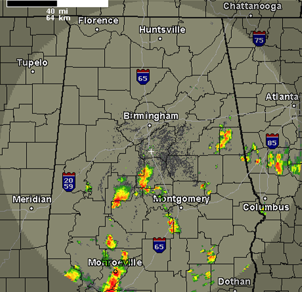
As expected this afternoon, we are seeing showers and storms develop across Alabama. The very moist air mass in place is being lifted by the onset of daytime heating and an upper-level low that is retrograding from the east back across Alabama.
This features is also allowing for showers and storm to move from east to west across the state this afternoon. Currently, all activity is south of Interstate 20. Some of the more intense storms were impacting portions of Perry, Bibb, Chilton, Montgomery, Lowndes and Randolph Counties. All storms are moving to the west.
Heading through out the rest of the afternoon, we are expecting additional showers and storms to develop and head west as well. Storms today will produce very heavy rain, small hail, gusty winds and very dangerous and frequent lightning. Severe storms are not expected, but the main threat from these storms could certainly be a flash flooding threat.
Additional storms will be moving in from western Georgia as well. Unsettled weather will last through the overnight hours and into Sunday. More widespread activity is expected on Sunday.
Category: Alabama's Weather
About the Author (Author Profile)
Macon, Georgia Television Chief Meteorologist, Birmingham native, and long time Contributor on AlabamaWX. Stormchaser. I did not choose Weather, it chose Me. College Football Fanatic. @Ryan_StinnetSubscribe
If you enjoyed this article, subscribe to receive more just like it.


