

Showers Increasing, Storms Soon
Regional radars re busy this afternoon, especially west of I-65, which the mesoscale models accurately predicted.
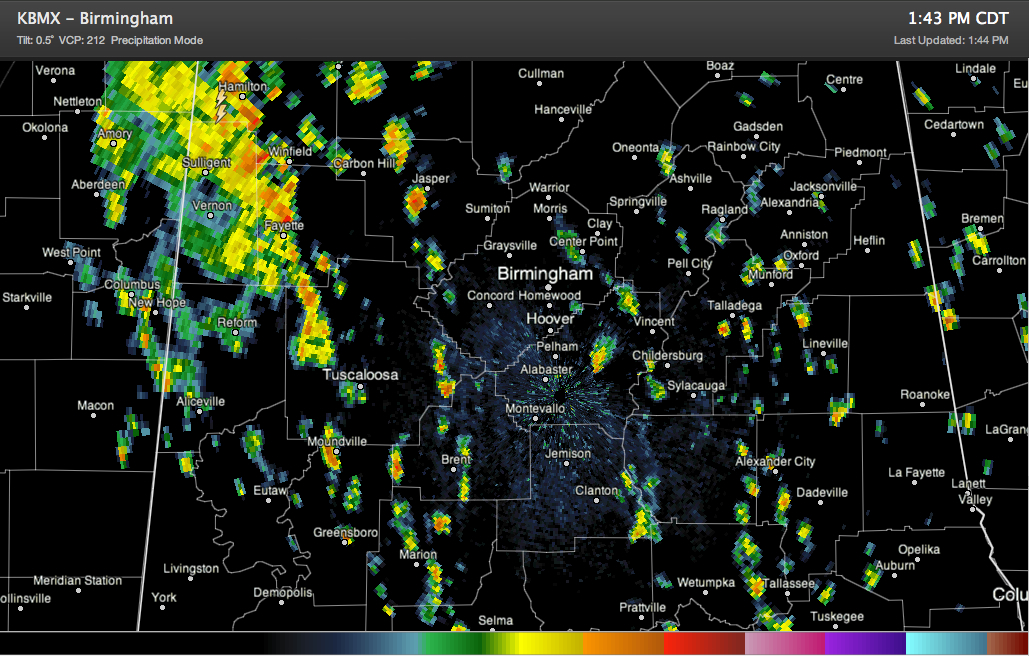
Showers and storms were most numerous west of a line from Jasper to Selma just before 2 p.m. and heaviest and most concentrated over Lamar, Marion, Fayette and northern Tuscaloosa Counties.
East of I-65, activity was more scattered, but even there, if you find yourself under one of these heavy showers, you’ll know it with brief heavy rain. Lightning will be on the increase as we go through the afternoon hours as well, as the storms gain height.
Showers and storms will continue to slowly shift westward with time, but will last until after midnight in some western sections.
It was 75F at Tuscaloosa with heavy rain last hour, while it was 81F in Birmingham and 85F at Anniston. You can clearly tell that temperatures are dependent on the clouds and precipitation this afternoon.
Rain chances will be dropping over the next few days, and the mercury will be headed the other direction as we delve deeper into the hottest part of the year here climatologically.
Category: Alabama's Weather
About the Author (Author Profile)
Bill Murray is the President of The Weather Factory. He is the site's official weather historian and a weekend forecaster. He also anchors the site's severe weather coverage. Bill Murray is the proud holder of National Weather Association Digital Seal #0001 @wxhistorianSubscribe
If you enjoyed this article, subscribe to receive more just like it.


