Storms Over Shelby County
LATE NOTE
Brian Peters reports 0.72 inches of rain in 15 minutes in Helena as of 9:28.
ORIGINAL POST
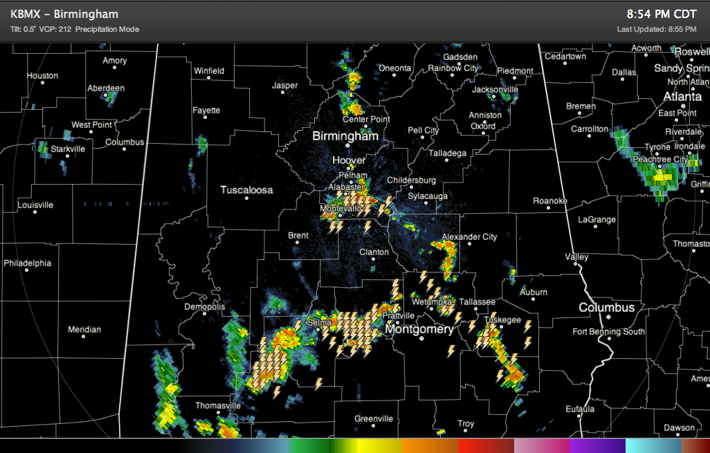
Showers and thunderstorms continue across parts of Central Alabama tonight. They are still fairly strong across Shelby County from Montevallo to Columbiana. These storms are moving northwestward across Shelby County and will reach southern Jefferson County from Hoover over to Bessemer.
A band of heavy thunderstorms extends across South Central Alabama from Camden to Autaugaville to Wetumpka and up to Rockford. Other storms extend back southeastward to the Union Springs area.
These storms may hold together or even increase in coverage a little over the next couple of hours as they push into West Central and Northwest Alabama.
Heavy showers are also over northern Jefferson County from Pinson to Morris and up into southern Blount County near Smoke Rise.
There is a heavy shower approaching Boaz in Marshall County.
The heavier storms will have frequent lightning with them. All of the heavier showers will have brief heavy rain.
Category: Alabama's Weather
About the Author (Author Profile)
Bill Murray is the President of The Weather Factory. He is the site's official weather historian and a weekend forecaster. He also anchors the site's severe weather coverage. Bill Murray is the proud holder of National Weather Association Digital Seal #0001 @wxhistorianSubscribe
If you enjoyed this article, subscribe to receive more just like it.


