

Scattered Strong Storms Continue
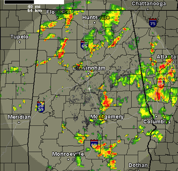
We are still seeing strong storms across the Alabama landscape this afternoon. Storms have been pulsing up and down in intensity today and over the last few radar scans we have seen several storms pulse up.
The most intense storms currently are affecting Walker, Winston and Coosa Counties. We are beginning to see some storms re-develop in Jefferson County as well and there are affecting Birmingham and areas around Irondale, Center Point, Homewood, and Mountain Brook.
Storms will continue to develop at least until the sun set this evening. Storms will last into the evening but will begin to wind down heading into the overnight hours.
Once the storms develop, that are moving off to the east-northeast are producing very heavy rainfall, gusty winds, perhaps some hail. These storms are also producing tremendous amounts of lightning as well.
Category: Alabama's Weather
About the Author (Author Profile)
Macon, Georgia Television Chief Meteorologist, Birmingham native, and long time Contributor on AlabamaWX. Stormchaser. I did not choose Weather, it chose Me. College Football Fanatic. @Ryan_StinnetSubscribe
If you enjoyed this article, subscribe to receive more just like it.


