Prodigious Lightning, Rain Producers
The storms over West Central Alabama are producing torrential rains and tremendous lightning.
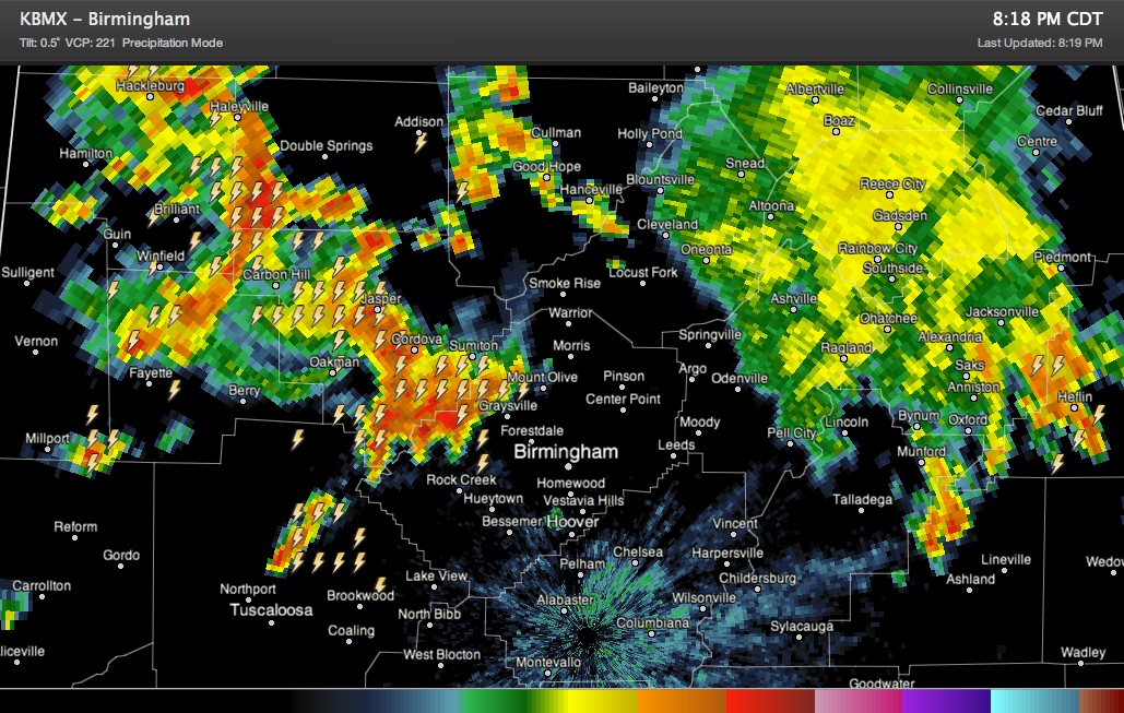
Richard Viola reports that the lightning to the west of Lake View toward Tuscaloosa is very impressive.
They are moving generally east northeast, but they seem to be backbuilding into the northern part of the Birmingham Metro area. Hopefully they will stay north of the areas that experienced flash flooding earlier.
But it does look like the new storms will impact areas in northern Jeferson County that have had between 4-5 inches of rain this weekend. Terry Sasser in the Gardendale/Fultondale area has had 4.75 inches of rain so far.
Main areas of impact in the next hour will be eastern Marion, much of Winston, Fayette, much of Walker and northern Jefferson Counties. Eventually Cullman County will be affected.
Intuitively, you would think that they storms will weaken as we lose the heating of the day and as the storms move into an airmass that was worked over by the earlier storms, but until we see that, you will want to be indoors as they approach and off roads in the path of them.
Remember, turn around, don’t drown.
Category: Alabama's Weather
About the Author (Author Profile)
Bill Murray is the President of The Weather Factory. He is the site's official weather historian and a weekend forecaster. He also anchors the site's severe weather coverage. Bill Murray is the proud holder of National Weather Association Digital Seal #0001 @wxhistorianSubscribe
If you enjoyed this article, subscribe to receive more just like it.


