Severe Weather Risk for Today
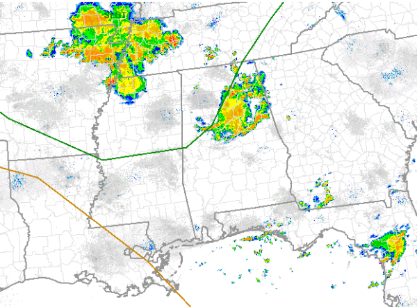
This morning is an active one across Alabama, the first round of showers and thunderstorms are impacting many locations across Central Alabama. Northwest flow will continue to send impulses of energy across the region and will also send complexes for storms across the state. The first complex is pushing off to the southeast of Birmingham now, another larger and more intense complex is around the Memphis area now and will be heading our direction down Interstate 22 through out the morning. It will be impacting us by late in the morning or early afternoon.
We are also paying attention to the threat of severe weather as well. The latest day one convective outlook issued by the SPC has essentially the northwest quarter of Alabama in their standard “slight” risk for severe weather today. The risk area, outlined in green on the graphic includes areas north and west of a line that runs through Pickens, Tuscaloosa, western Jefferson, Cullman, Marshall and Jackson Counties. The main severe weather threat damaging winds, but we will also have to watch for the chance for hail. Tremendous amount of lightning as well as copious amounts of rain will be likely. We will certainly have to watch out for a flash flooding threat today.
Category: Alabama's Weather, Severe Weather
About the Author (Author Profile)
Macon, Georgia Television Chief Meteorologist, Birmingham native, and long time Contributor on AlabamaWX. Stormchaser. I did not choose Weather, it chose Me. College Football Fanatic. @Ryan_StinnetSubscribe
If you enjoyed this article, subscribe to receive more just like it.


