Thunderstorms Over North Central Alabama
Thunderstorms have developed this morning over North Central Alabama. They are currently affecting extreme southern Morgan and northern Cullman Counties, with some showers over Blount County.
Here is the radar at 9:16:
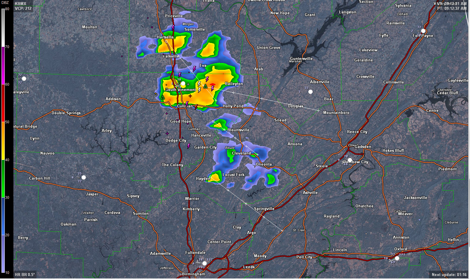
The activity is moving southeast and will affect areas from the City of Cullman over to Holly Pond down to Hanceville, Blountsville and Snead in the next hour.
Tops of the storms over Cullman County are over 40,000 feet, hence the lightning.
A note from Bob Kusz: “This is getting ridiculous. Another heavy thunderstorm as I’m typing this three miles morth of Holly Pond. Frequent lightning (though not near as intense as yesterday) and heavy rain. Total rainfall yesterday was 3.38 inches. I’ll keep posted as this continues to pile up.”
And a late report from Bob at 9:40: .72 hundredths of an inch in the first twenty minutes and still raining heavy. Lightning has decreased considerably.
Elsewhere over Central Alabama, there are showers over Tuscaloosa and northern Hale Counties in the western part of the state, but they are not heavy.
A cool front is dropping into North Alabama. It will trigger scattered showers and storms as it pushes south through the day. The front should reach the I-20 corridor by sunset.
Rain chances will drop to near zero for Thursday and Friday across Central Alabama as moisture levels drop. Lows tomorrow morning will be in the 60s in many spots and everyone should be in the 60s Friday morning. Quite refreshing for July!
Category: Alabama's Weather
About the Author (Author Profile)
Bill Murray is the President of The Weather Factory. He is the site's official weather historian and a weekend forecaster. He also anchors the site's severe weather coverage. Bill Murray is the proud holder of National Weather Association Digital Seal #0001 @wxhistorianSubscribe
If you enjoyed this article, subscribe to receive more just like it.


