Quick Evening Radar Check
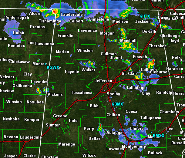
Scattered showers and storms have developed in several locations across Central Alabama this evening. Some of the more intense storms currently are affecting portions of Calhoun, Talladega and Walker Counties. Storms are producing gust winds, frequent and dangerous lightning and torrential rain.
Over the next few hours storms will continue to drop towards the southeast. Additional storms are expected to develop ahead of a line of storms that is moving into the Tennessee Valley of Alabama. This line will progress towards the south over the next few hours and will be impacting the Birmingham Metro after 9 PM.
Severe storms are not expected, but some storms could be strong with the main threat being flash flooding.
Category: Alabama's Weather
About the Author (Author Profile)
Macon, Georgia Television Chief Meteorologist, Birmingham native, and long time Contributor on AlabamaWX. Stormchaser. I did not choose Weather, it chose Me. College Football Fanatic. @Ryan_StinnetSubscribe
If you enjoyed this article, subscribe to receive more just like it.


