More Showers and Storms Developing
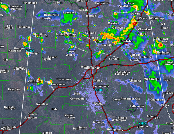
Convection continues to develop this evening and the radar is really beginning to fill in across North-Central Alabama. Activity is dropping to the east-southeast and will continue that movement through the overnight hours.
Some of the more intense activity is occurring in Pickens, Tuscaloosa, Blount, Marion and Cullman Counties. Storms are producing gusty winds, tremendous amount of lightning and torrential rainfall. Watch for ponding on roadways and some isolated flash flooding could occur.
Showers and storms should impact most areas of Central Alabama the next few hours as a cold front is dropping south across the state. Unsettled weather will last into tomorrow and we should begin to dry out by tomorrow afternoon as drier air once again settles into Alabama.
Category: Alabama's Weather
About the Author (Author Profile)
Macon, Georgia Television Chief Meteorologist, Birmingham native, and long time Contributor on AlabamaWX. Stormchaser. I did not choose Weather, it chose Me. College Football Fanatic. @Ryan_StinnetSubscribe
If you enjoyed this article, subscribe to receive more just like it.


