Midday Radar Check
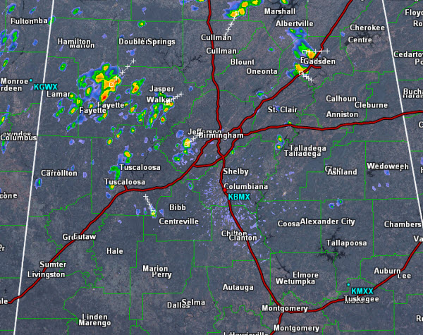
Late this morning, showers and thunderstorms have started bubbling up across the Alabama landscape. Western portions of the state is where a majority of the activity has been thus far.
Storms will be strong today, but should remain below severe limits. Gusty winds, frequent lightning and torrential tropical downpours will occur with these storms. Isolated flash flooding will remain the greatest threat from today’s convection.
Currently, the heavier activity has been affecting portions of Fayette, Walker, Jefferson, Tuscaloosa and Etowah counties. Storm movement today has been towards the northeast. Expect additional activity to pop up through out the afternoon and it should last into the evening hours. Like we see each day, storms should slowly begin to dissipate once the sun sets.
Category: Alabama's Weather
About the Author (Author Profile)
Macon, Georgia Television Chief Meteorologist, Birmingham native, and long time Contributor on AlabamaWX. Stormchaser. I did not choose Weather, it chose Me. College Football Fanatic. @Ryan_StinnetSubscribe
If you enjoyed this article, subscribe to receive more just like it.


