Showers Continue, More Storms Possible Later
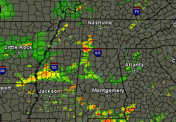
Heavy rain fell across eastern portions of the state this morning. That rain has since dissipated and now the rain is confined to western portions of the state. Locations in Marion and Winston counties are seeing the more intense rain currently. There are additional storms across the Tennessee Valley of Alabama and these storms will continue to drop towards the south through the afternoon.
Where the rain has fallen and the clouds are hanging around, temperatures remain cool and comfortable for early September. Locations that haven’t see the rain are seeing highs in the upper 80s and lower 90s.
Heading throughout the afternoon, additional showers and storms will be possible. A frontal boundary is slowly sinking south today. The front was located along a line from Little Rock to Memphis to near Louisville. There are a few thunderstorms along the front and with a warm, moist atmosphere in place, additional convection can be expected today. Until the front passes through, these showers and storms will remain a possibility today. The main concern with thunderstorms today will be an isolated threat for flash flooding. Once the front passes, drier air will be settling in and will send our rain chances to near zero the rest of the week.
Category: Alabama's Weather
About the Author (Author Profile)
Macon, Georgia Television Chief Meteorologist, Birmingham native, and long time Contributor on AlabamaWX. Stormchaser. I did not choose Weather, it chose Me. College Football Fanatic. @Ryan_StinnetSubscribe
If you enjoyed this article, subscribe to receive more just like it.


